- The western side, from Lewis Pass to the Waiau River is characterised more by mixed beech forests, open river flats, tussock tops rising to rocky snow mountain tops.
- In contrast, the eastern side is drier, open country with magagouri, exotic grasses, regenerating shrublands and mountain lakes.
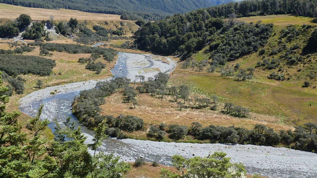
- The Waiau River runs north to south through the St James Conservation Area.
You can access the St James Conservation Area either from the west side on SH 7 or on the eastern boundary along Tophouse Road.
West - SH 7 and St James Walkway
The western side provides access to the St James Walkway which starts and finishes on SH 7. Entry points are either at the top of the Lewis Pass just off the car park and picnic area, or at the Boyle Village from SH 7, Lewis Pass Road. There is no further vehicle access from SH 7, and please note that mountain bikes and horses are not permitted on the St James Walkway.
Do not trespass onto Glenhope Station.
Glenhope Station’s boundary surrounds Boyle River on the section of St James Walkway from Boyle Village to Magdalen Hut. Stay on the track and note that hunting is not permitted on Glenhope Station – offenders can be prosecuted for trespassing and poaching.
East - Hanmer Springs and Tophouse Road
The east side of the St James Conservation Area can be reached via Hanmer Springs.
From Hanmer Springs township, take Clarence Valley Road over Jacks Pass to connect with Tophouse Road (approximately 13 km from Hanmer Springs). This road follows the eastern boundary of the conservation area as far as Lake Tennyson. This road follows the eastern boundary of St James Conservation Area to Lake Tennyson. All tracks along this road are open to cyclists, horse riders and walkers.
Off-road parking is available at St James Homestead and at the entrances to Maling Pass and Fowlers Pass tracks. Do not leave valuables in your vehicle.
Public transport
There is no regular public transport along this route although there are numerous options for chartering transport from Hanmer. The latest information is available at the Hanmer Springs isite (+64 3 3150020), 10 am - 5 pm, 7 days a week, except for Christmas Day.
Distance from main centres
- Christchurch 190 km
- Nelson 224 km
- Picton 296 km
- Greymouth 145 km
St James is an alpine environment, subject to weather extremes, flooded rivers and avalanches. Visitors must be prepared for the worst at all times:
- Take clothing for all weather conditions regardless of the forecast, as well as extra food / water supplies.
- Tell someone where you are going and when you plan to return.
- Treat all rivers with respect; never attempt to cross swollen rivers or streams.
- There is no cell phone coverage in this area. You are on your own unless you take or hire a satellite phone, mountain radio or personal locator beacon (hire outlets are listed on www.beacons.org.nz)
- Topographical maps are essential for all backcountry trips. Check with your closest DOC office, visitor centre or this website that all tracks and huts are open before leaving.
- Your safety is your responsibility.
Dogs
You can take dogs onto St James east of the Waiau River (ie: access from Tophouse Road).
To protect its high conservation values and vulnerable native birds, particularly kiwi, dogs are not permitted west of the Waiau River.
Dogs must be kept under control at all times. Clean up after your dog and remove any faeces. Dogs are not permitted in any of the huts.
Fire
Fire is always a conservation concern in the high country. There will be no open fires in the St James Conservation Area.
There may be avalanche danger
Find out about avalanche danger in St James Conservation Area
Avalanches in St James Conservation Area can occur in any season, but are more common from May to November.
If you are going into avalanche terrain:
- Have avalanche skills and training.
- Check the ATES rating and the St James Conservation Area weather forecast
- Take and know how to use an avalanche transceiver, a snow shovel and a probe.
The government purchased St James Station as public conservation land in 2008, funded by the Nature Heritage Fund.
It was purchased to protect its natural, physical and cultural values and to open it up to outdoor recreation and tourism.
Biodiversity
Vegetation within the area includes red, mountain and silver beech/tawhairauriki/ tawhairaunui forests, mānuka/kānuka and matagouri scrublands, numerous alpine species, at least five species of tussock, and a vast expanse of valley-floor native grasslands. Some 430 indigenous species of flora and 30 native bird species have been identified.
St James Conservation Area was one of the largest operating cattle/sheep stations in the country, dating back to 1862.
Māori access routes across the top of the South Island ran through the station, and there are a number of early European pastoral farming historic sites including old homesteads, huts, and rabbit fences.
St James Station, like many of the early larger Canterbury runs, was an amalgamation of several smaller runs.
Check, Clean, Dry
Clean all gear when moving between waterways to prevent the spread of didymo and other freshwater pests.
Arthur's Pass National Park Visitor Centre
| Phone: | +64 3 318 9211 |
| Email: | arthurspassvc@doc.govt.nz |
| Address: | 104 West Coast Road Arthur's Pass 7654 |
| Hours: | Visitor centre hours and services |