Mount Barrosa/Mount Somers hunting
Located in Mid & South Canterbury hunting in the Canterbury region
|
Introduction
Open season all year for red deer, chamois, pigs and goats.Species
- Chamois
- Deer - Red
- Goats
- Pigs
Permit requirements
This hunting area is covered by an 'open area permit' – get it online or from a DOC office.
Dog access
About this hunting block
General information
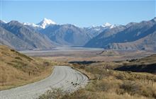
This area is centred on Mount Somers (1,688 m) and Mount Barrosa (1,364 m). Both areas are steep with some mountain beech forest giving way to tussock and alpine herbfields at higher altitudes.
This area adjoins Palmer Range/Taylor Range to the north.
Be aware no hunting is allowed:
- in Sharplin Falls Scenic Reserve
- near Woolshed Creek
- near the Pinnacles Huts
- true left of Taylors Stream.
Access
Mount Somers: From Mt Somers village follow the Ashburton Gorge Road to Jig Road and on to Woolshed Creek carpark. Access is also available from Flynns Road at Staveley.
Mount Barrosa: From Mt Somers village follow Ashburton Gorge Road to Stour River carpark or the access easement to Mt Barrosa. Alternatively, follow Ashburton Gorge Road to Hakatere, then follow Hakatere Heron Road to Castleridge Station and the 4WD track to Lake Emily.
Helicopter landings will not be approved.
Topo maps
NZTopo50 map sheets: BX19 Hakatere, BX20 Methven
Huts
Backcountry Hut Tickets or a Backcountry Hut Pass is required.
Know before you go
Help control wallabies in this area by reporting sightings
Wallabies can displace other species, affect pastures and native species' habitats.
They also potentially impact production and native ecosystems.
Report your sighting online – it only takes a few minutes.
You can also report wallaby sightings by calling 0800 80 99 66.
Contacts
| Raukapuka / Geraldine Office | |
| Phone: | 0800 275 362 |
| Email: | info@doc.govt.nz |
| Address: |
13 – 15 North Terrace Geraldine 7930 |
| Postal Address: |
PO Box 33 Geraldine 7956 |
| Full office details | |


