10.1 km one way
Video

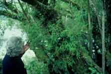
Dendrobium cunninghamii orchid on
a tree trunk, Kaniere Walkway
Starting (or ending) at the road end just past Sunny Bight picnic area, the Lake Kaniere Walkway is a four hour tramp around the western shore of Lake Kaniere. The walkway emerges at the southern end of the lake on the Dorothy Falls Road.
It is a four hour return walk back along the same track.
Highlights of the walk include many picturesque bays, numerous forest streams and lush lakeside forest. A lookout point over the lake is offered part way up Mt Upright/Te Taumata o Uekanaku.
There are numerous places to take a dip. Or when you have finished walking or riding Hans Bay is a popular local swimming spot.
Mountain biking
The Lake Kaniere Walkway provides advanced grade 4 riding with a short section of expert, advanced grade 5 track near the Southern (Dorothy Falls) end.
Riders will encounter a technical and narrow track, rough surfaces with exposed tree roots. The track is steep in places with large drop offs.
Bikes are required to be carried due to a section of stairs in one section.
From Hokitika head east 19 km along Lake Kaniere Road, this road meets the lake at 'The Landing'. The road forks at this point, the right road heads to 'Sunny Bight' and the other is Dorothy Falls Road which takes you around the east side of the lake past Hans Bay.
The walk is suitable for people of average fitness and tramping boots are required.
For track conditions, maps, weather forecasts and more information on the area contact the Hokitika DOC office.
Stay safe in the outdoors
- Choose the right trip for you. Learn about the route and make sure you have the skills for it.
- Understand the weather. Check weather forecasts.
- Pack warm clothes and extra food. Check gear lists.
- Share your plans and take ways to get help. Share directly or use the Outdoor Intentions form or Plan My Walk. Take a distress beacon.
- Take care of yourself and each other.
Paparoa National Park Visitor Centre
| Phone: | +64 3 731 1895 |
| Email: | paparoavc@doc.govt.nz |
| Address: | 4294 Coast Road Punakaiki RD 1 Runanga 7873 |
| Hours: | Visitor centre hours and services |