7 km return return via same track
Image gallery
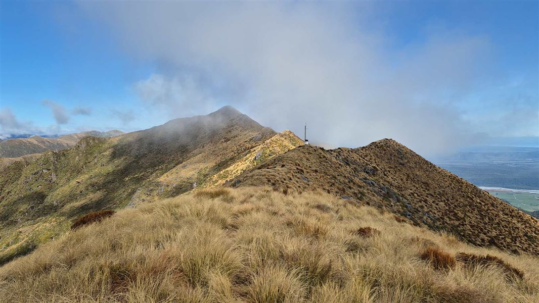
The track passes through mixed lowland rimu forest that also features some kaikawaka and silver pine, to the top of Mt French (1305 m).
It's a steady climb but, on a fine day, the views of Lake Brunner and the inland to the Southern Alps reward the effort.
The track start on Kumara-Inchbonnie Road, on the south end of Lake Brunner. Lake Brunner is inland from Greymouth, between SH 73 and SH 7.
Turn off SH 73 at Kumara into Kumara-Inchbonnie Road (17 km), or at Jacksons into Lake Brunner Road, which leads into Kumara-Inchbonnie Road (23 km).
This track is steep and slippery in places and even on fine days the tops can become clouded quickly making navigation difficult on the rugged tops.
Wear sturdy footwear (preferably boots), carry warm, waterproof clothing and take enough snacks, drinking water and equipment needed for a full day walk. If venturing along the tops take a map.
Stay safe in the outdoors
- Choose the right trip for you. Learn about the route and make sure you have the skills for it.
- Understand the weather. Check weather forecasts.
- Pack warm clothes and extra food. Check gear lists.
- Share your plans and take ways to get help. Leave your intentions with a trusted contact and take a distress beacon.
- Take care of yourself and each other.
Paparoa National Park Visitor Centre
| Phone: | +64 3 731 1895 |
| Email: | paparoavc@doc.govt.nz |
| Address: | 4294 Coast Road Punakaiki RD 1 Runanga 7873 |
| Hours: | Visitor centre hours and services |