This marine reserve was established in 2008 and is 855 hectares.
A significant sewage leak at the Moa Point wastewater treatment plant may affect the water quality in the marine reserve. Check Moa Point Wastewater incident - Information hub for current safety conditions.
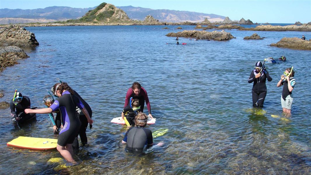
Image gallery
Taputeranga Marine Reserve is approximately 6 km from Wellington City centre. Buses run regularly from central Wellington to Island Bay, Houghton Bay, and nearby Lyall Bay.
Fishing and the removal or disturbance of any living or non-living marine resource is prohibited, except as necessary for permitted monitoring or research. If you come across any research equipment, do not disturb it.
There are also penalties for:
- discharging toxic substances or pollutants
- disturbing wildlife such as marine mammals and birds
- wilfully damaging marine life or the natural features of the reserve
- building an unauthorised structure
- littering.
If you see people taking anything from the reserve, report the activity to 0800 DOC HOT (0800 362 468). Also report pollution, oil spills, navigation hazards and dangerous boating to Greater Wellington Regional Council's Environmental Protection Hotline (0800 496 734).
Other regulations
- Swing moorings are permitted within the reserve provided all other legal requirements related to the swing mooring are met.
- With the implementation of the reserve, if a contaminant is being discharged within or into the marine reserve, the discharge of the contaminant may continue provided all other legal requirements are met.
- Existing structures may remain and be maintained within the reserve.
- Rock lobster caught in the wild outside of the reserve may be held temporarily in holding cages in a specified area in Island Bay.
Dogs
Dogs are prohibited on the beaches of Princess Bay and eastern Island Bay. There are dog exercise areas at Houghton Bay and Island Bay west of the pier.
Visit wellington.govt.nz/dogs to find out more.
Drones may require authorisation
Drones can:
- disturb, injure or kill native birds
- disturb marine mammals
- disturb other visitors.
An authorisation is required from DOC to use drones near marine mammals for any reason, including private use. Find more information and apply for authorisation.
Dogs
Protect the wildlife. Your dog is dangerous to native marine life – the smallest dogs have killed penguins. If taking dogs into the reserve, remember that seals are sensitive to disruption and will try to escape to sea if they feel threatened. Keep your dog on a lead, stay at least 20 m away and don’t feed seals.
Marine life
Several water currents and its unique underwater landscape help support of a diverse and thriving ecosystem.
Taputeranga is home to over 180 fish species recorded along the south coast. Octopus, rock lobsters, crabs and starfish are common. Anemones, sea sponges and sea squirts thrive. There's plenty of beaches and rocky shores to explore at low tide.
No two days are the same at Taputeranga. The weather is changeable and the water churns through Cook Strait, creating a moody and complex undersea environment.
The reserve lies along Wellington's exposed southern coastline. It is swept by strong tidal currents bringing nutrients from Cook Strait, and pounded by swells from the southern ocean. This creates ideal growing conditions for seaweeds, particularly the large browns.
Kelp forests thrive in sheltered places such as Island Bay and have been known to grow up to 20 m in length. About 400 species of seaweed have been recorded within the reserve.
Drifting in and out of the seaweeds you will see
- butterfish
- blue moki
- marblefish
- and smaller pickers such as spotty, banded and scarlet wrasse.
Long finger reefs separated by gravel filled channels run offshore.
There is a variety of birdlife in the reserve too, such as:
- oystercatchers and reef herons close to shore
- whitefronted terns just off the coast
- large albatrosses soaring above the waves out to sea.
Little blue penguins breed on the south coast, protected from predators by traps and custom-built nest boxes. Look for fur seals lazing on the rocks or sunning themselves on the water surface. From the shore you may also see large pods of dolphins, orcas, seals and even whales.
The abundance of species in the marine reserve area have increased since the reserve was formed in 2008.
Community groups, research institutes, and organisations are key to keeping this reserve clean and connecting people to nature.
- Friends of Taputeranga Marine Reserve
- Mountains to Sea Wellington
- Island Bay Education Centre
- Wellington Underwater Club
- Victoria University’s Coastal Ecology Laboratory
Reporting pest species
If you find something unusual that may be a pest:
- Record it: take photos and note the location and vessel name (if relevant).
- Identify it: upload your photo to iNaturalist for help from the online community.
- Report it: if you think it could be a new or harmful pest or disease, report it to the Ministry for Primary Industries (MPI) as soon as possible by calling 0800 80 99 66 or completing MPI’s online reporting form.
Report illegal or suspicious activity
Don't take, disturb, kill or damage anything within the reserve - it's illegal. If you see people taking anything from the reserve, report the activity as soon as possible.
You can call 0800 4 POACHER (0800 476 224) or 0800 DOCHOT (0800 362 468).
It is also an offence to pollute or litter the reserve, discharge any firearm in or into the reserve or erect any structure in the reserve.
The Wellington south coast’s early inhabitants relied on its abundant seafood. When European fishers arrived, they built narrow boat ramps that can still be seen carved into rocky reefs.
A marine reserve here was proposed in 1987 to protect culturally important sites, diverse plants and animals, undersea reefs and biological oddities for restoration, recreation and study. Taputeranga reserve was officially opened in 2008. The local community played a major role in the application process and is still involved with the reserve.
Protect our marine reserves
- No fishing of any kind.
- Don't take or kill marine life.
- Don't remove or disturb any marine life or materials.
- Don't feed fish - it disturbs their natural behaviour.
- Take care when anchoring to avoid damaging the sea floor.
DOC Customer Service Centre
| Phone: | 0800 275 362 |
| Email: | info@doc.govt.nz |