Kapiti Island is a popular destination all year round, so during the peak summer season transport bookings need to be made well in advance.
Boulder Bank Loop Track closed from October to March due to nesting birds.
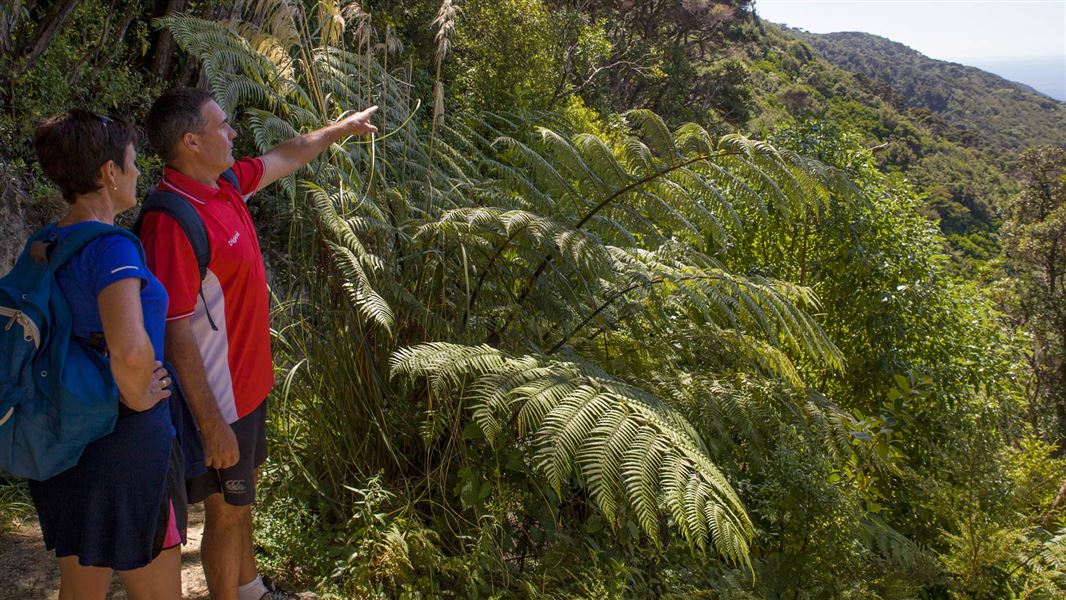
Two areas on the island open to the public are Rangatira, halfway along the eastern shore, and the northern end.
Rangatira area walks
Walk through forest to view birds and the historic whare, the oldest building associated with nature conservation in New Zealand. Or climb the track toTuteremoana, the highest point on Kapiti Island at 521 m above sea level.
Rangatira Loop walk
Time: Up to 1 hr 30 min loop
Distance: 1.8 km loop
Start at the Rangatira shelter and enjoy an easy walk through regenerating forestand coastal shrubland. See whaling trypots (artefacts from the island’s whalinghistory) and the historic whare. Explore the Rangatira wetland via a boardwalk, then walk around the coastal section back to the shelter.
Wilkinson Track
Time: 2 hr one way
Distance: 3.8 km one way
Walk to Tuteremoana along a well-formed track with a steady uphill climb. Pass a picnic area and hihi feeding station a third of the way up. There is a toilet 10 minutes from the summit. This is an ideal track for all ages and fitness levels.
Trig Track
Time: 2 hr one way
Distance: 2 km one way
This is a more challenging walk to Tuteremoana with narrow, uneven sections. It is considerably steeper than the Wilkinson Track and should only be attempted by confident trampers with good, sturdy footwear. This is an uphill track only.
Northern end walks
Walking tracks at the northern end of the island pass through grassland, shrubland, regenerating forest and coastline, and provide fantastic views of freshwater Okupe Lagoon.
There is a shelter and toilet at the north end.
Okupe Valley Loop Walk
Time: 1 hr 30 min return
Distance: 4.8 km return
This walk follows a gentle gradient to a lookout above the western cliffs (198 m). The lookout is unfenced so supervise children carefully around the cliff edge.
Boulder Bank Loop Track
Time: 45 min loop
Distance: 2 km loop
This walk follows the coastline around the boulder bank.
This track is closed from October to March to avoid disturbing nesting seabirds.
Beach Landing to Shelter Track
Time: 5 min one way
Distance: 185 m one way
Start at beach edge and finish at the junction before north end visitor shelter.
Kapiti Island is 5 km off the west coast of the lower North Island,
Authorised tourism operators provide transport and tours of Kapiti Island. The island is a popular destination all year round so bookings for the popular summer season need to be made well in advance. Private boats may not land at Kapiti Island Nature Reserve.
Boat departure and parking
Boats depart from the Kapiti Boating Club at 1 Manly Road, Paraparaumu Beach. This is about a one hour drive north of Wellington.
To get there from the Paraparaumu traffic lights, turn into Kapiti Road and continue to the beach. The Boating Club is at the end of Kapiti Road.
Visitors to Kapiti Island can park at the Kapiti Boating Club or in the carpark across the stream from the club.
Trips to the island are weather dependent. Contact the tourism operator on the morning of your trip for a weather check and to confirm the departure time.
Wellington/Kapiti information
| Phone: | +64 3 546 9339 |
| Email: | nelsonvc@doc.govt.nz |
| About: | Whakatū/Nelson visitor services provide information for this area |