Image gallery
There are three routes up to Rangituhi/Colonial Knob, offering a loop walk taking from three to five hours.
One starts at the Broken Hill Road carpark (at Spicer Botanical Park). This is the more scenic route taking you into the Rangituhi/Colonial Knob Scenic Reserve, past the man-made lakes which once supplied water to Porirua Hospital, and through Kohekohe forest.
You can also get up from Raiha Street through the Porirua Scenic Reserve, and from Raiha Street up the gravel Farm Road to the radio station.
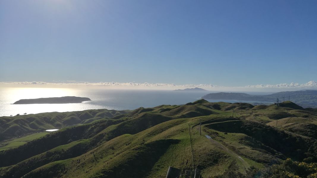
Take in the views from the top of this 468 metre high hill rising to the west of Porirua City. On a clear day you can view many other high points from the Inland Kaikoura Range in the south to Mt Taranaki in the north-west. Towards the north it's possible to see as far as Waikanae. Southward are the suburbs of Tawa and Johnsonville. Just below is the city of Porirua and its harbour (a unique drowned river valley) stretching out towards Paremata and the Pāuatahanui Inlet. The seaward outlook takes in Kapiti and Mana Islands, and on a clear day the South Island.
An Airways New Zealand radio station on Rangituhi/Colonial Knob assists with the radar control of aircraft, through a beacon which checks Hawkins Hill radar in Wellington and Tokomaru/Mount Robertson radar in the South Island.
The track starts at the Broken Hill Road carpark at Spicer Botanical Park, or from Raiha Street in Porirua.
The track passes through private farmland in places, keep to the marked route. No dogs or mountain biking.
Weather on the highly exposed summit can quickly change. Have raincoat, warm clothes, food, water and good walking shoes.
Related links
Early Māori named this peak Rangituhi (sky glow). Viewed from the harbour at sunset on a summer night the hills do indeed light up with a red glow.
Rangituhi/Colonial Knob is one of several remnants of a peneplain – an eroded landmass that existed 30 million to 40 million years ago, before it was raised by earthquakes and erosion began to form hills.
The trek to Rangituhi/Colonial Knob takes you through some of the last remaining native forest in the Tawa-Porirua basin. Most of its original cladding of rimu and rata was logged, although some mature trees survive in the Porirua Scenic Reserve.
The forest today comprises mainly kohekohe, tawa and some rewarewa. On the higher slopes it is dominated by mahoe with broadleaf, stinkwood and mapou. These species are often associated with higher altitudes, reflecting the influence of the weather on this environment.
Stay safe in the outdoors
- Choose the right trip for you. Learn about the route and make sure you have the skills for it.
- Understand the weather. Check weather forecasts.
- Pack warm clothes and extra food. Check gear lists.
- Share your plans and take ways to get help. Share directly or use the Outdoor Intentions form or Plan My Walk. Take a distress beacon.
- Take care of yourself and each other.
Wellington/Kapiti information
| Phone: | +64 3 546 9339 |
| Email: | nelsonvc@doc.govt.nz |
| About: | Whakatū/Nelson Visitor Centre provides visitor information for this area |
