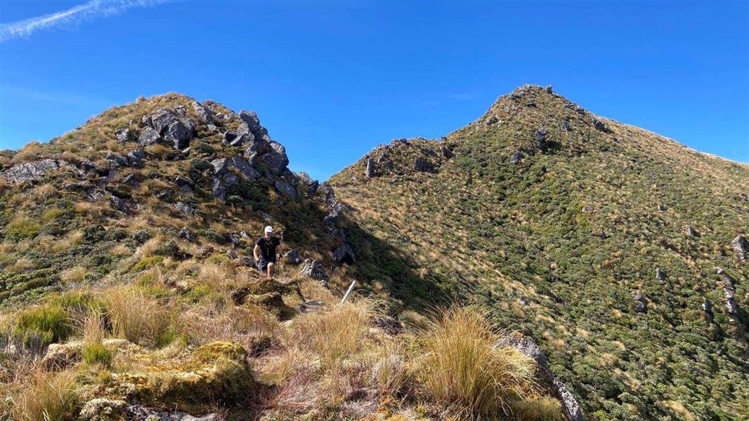
Dover Route to Pouakai Trig
The Dover Route begins on Carrington Road, near the junction with Dover Road. The route climbs steeply, leaving the bush part way up and entering the sub-alpine zone. The route follows the exposed Dover Spur and becomes increasingly steep as it climbs. At 1400 m, you reach the Pouakai Trig.
Return the same way or continue to Pouakai Hut (1 hr 30 min) or Holly Hut (2 hr).
Be aware that Dover Route is an expert-graded track. Expect overgrown sections of the track, tree windfalls and some scrambling over rocky outcrops. The track is above the bushline and exposed to the weather. Good visibility is essential.
If you are looking for a shorter or less technically demanding tramp in the same area, we recommend the Mangorei Track (which also leads to Pouakai Hut).
The track begins on Carrington Road, near the junction with Dover Road, around half an hour’s drive from New Plymouth.
There is a small car parking area beside Katikara Stream bridge just before the junction with Dover Road – this is the Dover Route entrance.
The Pouakai Trig and Dover Route is also accessible from the Pouakai Circuit.
Check the track is right for you
This is an expert route. It is 3 hr 30 min uphill and the track is rough and not regularly maintained. There are rocky outcrops with steep drop offs. It is best suited for people who are fit and experienced in backcountry New Zealand tramping (including navigating with a map and compass).
If you are not sure it is the right trip for you, we recommend considering nearby Mangorei Track.
Expect extreme weather
Taranaki is famous for its fast-changing and extreme weather. Check the forecast before you go and be prepared for rain and cold, even in summer.
This is an alpine area and it is common to have snow and ice on the higher parts of the track in winter. Contact the Egmont National Park Visitor Centre for current track conditions.
Pack warm and waterproof clothing
Be ready for any weather by packing a waterproof jacket and plenty of warm layers. Wear sturdy, comfortable shoes (tramping boots are recommended).
The majestic andesitic volcano Mount Taranaki or Egmont (2518 m) is the central point of the 34,170 ha Egmont National Park. Approximately 125,000 years old, it is the park’s most recent volcanic peak. Last erupting around 1755 AD the mountain is now considered dormant.
Local Māori believe Mounga (Mount) Taranaki once stood with the mountains of the central North Island. After a dispute over the maiden Pihanga, Taranaki fled his ancestral home, carving out the bed of the Whanganui River on his journey to the coast.
Egmont National Park became New Zealand’s second national park (after Tongariro) in 1900. Named Mount Egmont by Captain Cook, the traditional Māori name of Mount Taranaki is now more widely used.
Stay safe in the outdoors
- Choose the right trip for you. Learn about the route and make sure you have the skills for it.
- Understand the weather. Check weather forecasts.
- Pack warm clothes and extra food. Check gear lists.
- Share your plans and take ways to get help. Share directly or use the Outdoor Intentions form or Plan My Walk. Take a distress beacon.
- Take care of yourself and each other.
Taranaki/Egmont National Park Visitor Centre
| Phone: | +64 6 756 0990 |
| Email: | egmontvc@doc.govt.nz |
| Address: | 2879 Egmont Road Egmont National Park 4386 |
| Hours: | Visitor centre hours and services |
