2.7 km return via same track
The track begins from the end of the Woodside Glen Walk where it crosses Lee Creek, as indicated with an orange marker. From this point the track is an advanced tramping track so requires a higher degree of care. Follow the central path according to orange waymarks as you go up – there are many tracks used for other purposes such as hunting, which diverge into the bush.
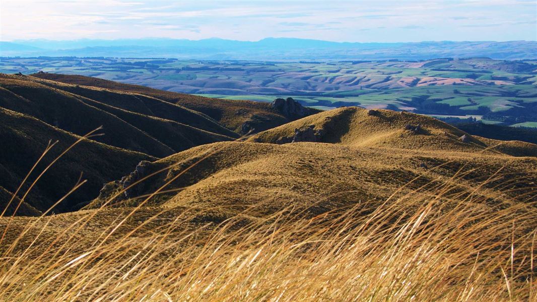
As you move upwards from the valley floor, experience a rare, unbroken transition in vegetation. Podocarp broadleaved forests shift through tawai/silver beech forest and montane shrubland, to low-alpine snow-grass and cushion bog communities as you reach the summit plateau. Pīwakawaka/fantails and other native birds and occasionally wild pigs or deer may be sighted.
Once reaching the bush-line where the tussock begins, orange poles mark the final ascent to a cluster of schist and the end of the track. Take a break from this vantage point and take in spectacular views that extend in all directions.
The managed track finishes at this orange marker. You will need to return via the same track.
The track starts at Woodside Glen Reserve which is approximately 30 min from central Dunedin.
From Dunedin city, travel through Mosgiel to Outram. Drive through Outram and follow SH87/Lee Stream-Outram Rd for approximately 9 km until reaching a turn-off on the left to Woodside Rd. Drive until an intersection and then take a right turn at Ravensburn St, at the end is the reserve.
There is no public transport option available for this track.
Visitors to Maukaatua should be prepared for a steady and somewhat challenging climb uphill to the open tussock tops. Correct footwear and clothing is essential.
Maukaatua can be exposed in bad weather and visibility can be impaired by fog – make sure you are adequately prepared.
Some sections of the track are steep and require care. Walking poles are recommended, especially during or after wet weather.
This track involves creek crossings. Flash flooding can occur during periods of high rain fall. Avoid the area during or immediately after periods of heavy rain.
There are several picnic tables close to the entrance of the Woodside Glen reserve.
There are no toilets or bins at this site. Make sure to take your rubbish with you when you leave.
The Woodside Glen reserve gates will be open at differing times seasonally:
- November – March: 8 am–9 pm
- April – September: 9 am–5 pm
Stay safe when crossing rivers
If you plan to cross unbridged rivers, know how to cross safely and be prepared for if you cannot cross.
Do not cross if the river is flooded, you cannot find safe entry and exit points or are unsure it’s safe. Turn back or wait for the river to drop. If in doubt, stay out.
Stay safe in the outdoors
- Choose the right trip for you. Learn about the route and make sure you have the skills for it.
- Understand the weather. Check weather forecasts.
- Pack warm clothes and extra food. Check gear lists.
- Share your plans and take ways to get help. Share directly or use the Outdoor Intentions form or Plan My Walk. Take a distress beacon.
- Take care of yourself and each other.
DOC Customer Service Centre
| Phone: | 0800 275 362 |
| Email: | dunedinoffice@doc.govt.nz |
| Address: | Ōtepoti / Dunedin Office |
