12 km one way
The Catlins River Walk is a well formed tramping track following the Catlins River between The Wisp and the Tawanui camping ground. There are a few short steep grades and can be walked in sections, via connecting tracks from the forestry road.
Sections of the track can be walked independently of the others, as there are many entry/exit points along the way.
Section walking times:
- Tawanui to Franks Creek – 2.5 hr
- Franks Creek to Wallis Stream – 1.5 hr
- Wallis Stream to The Wisp – 1 hr
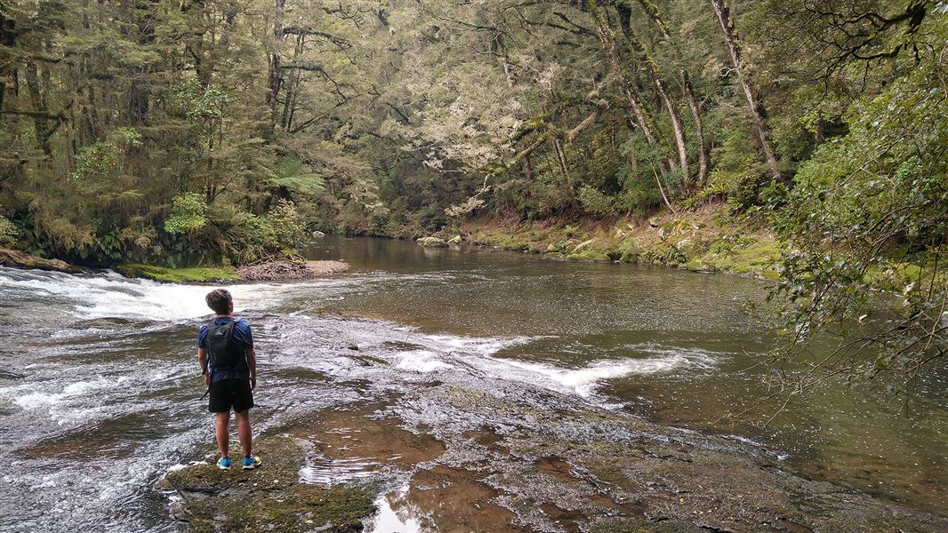
The first part of the track is through exotic forest which soon gives way to silver beech. Over the length of the track four wire-rope suspension bridges cross the Catlins River with it many waterfalls and rapids.
There are opportunities to see rare birds such as the rifleman and möhua/yellowhead. At the Tawanui end many of the silver beech trees host the native mistletoe Peraxilla colensoi. In December/January it is worth looking out for this hemi-parasite’s impressive scarlet flowers.
Side tracks
Wisp Loop Walk
The 4-5 hour higher-altitude Wisp Loop Walk forms a loop with the Catlins River Walk. At the end of the walk there is a picnic area with a toilet.
The Wisp Loop returns along the forestry roads and this could be mountain biked separately.
Rocky Knoll
The Rocky Knoll extension track on the Rata Range is a side route that runs off the Wisp Loop Walk. It gives extensive views to the coast and over the inland Catlins.
The track has easy walking along foresty roads, where you will see plantation radiata pine, douglas fir, eucalyptus forest, silver beech forest and sub-alpine vegetation.
South of Owaka on the Southern Scenic Route SH92, turn right onto Catlins Valley Road, right onto Morris Saddle Road, then left at cattle-stop.
- Road access to The Wisp is via the Chloris Pass Road from the Owaka Valley.
- Road access to the Tawanui Camping ground is via an extension of Catlins Valley Road or Morris Saddle Road from Owaka Valley.
- Rocky Knoll Loop may occasionally close because of forestry operations. Check with the DOC Owaka office +64 3 419 1000 or Rayonier Southland +64 3 211 1290 before setting out .
- Rocky Knoll Walk has exposed sections - check the weather before setting out.
Stay safe in the outdoors
- Choose the right trip for you. Learn about the route and make sure you have the skills for it.
- Understand the weather. Check weather forecasts.
- Pack warm clothes and extra food. Check gear lists.
- Share your plans and take ways to get help. Leave your intentions with a trusted contact and take a distress beacon.
- Take care of yourself and each other.
DOC Customer Service Centre
| Phone: | 0800 275 362 |
| Email: | invercargill@doc.govt.nz |
| Address: | Murihiku / Invercargill Office |