5.7 km one way
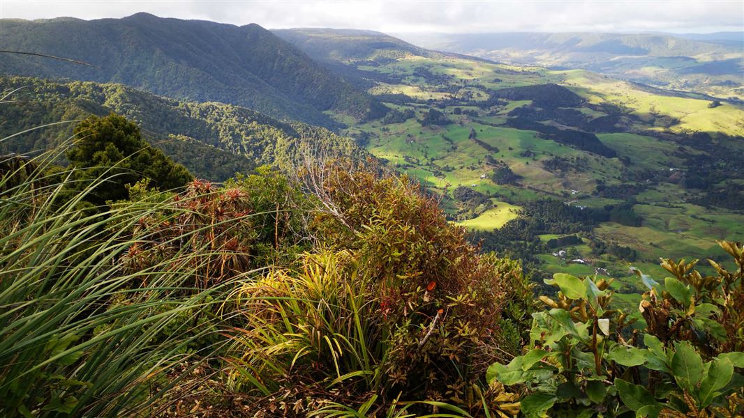
The climb up Hauturu (679 m) is steep and slippery when wet but the views you can get at the top are worth the climb. Note, reaching the trig requires a short detour off the main track - allow extra time.
The track starts at the top of the Waiotemarama Waterfall Walk. It connects with the Waimā Main Range Track.
The track starts at the top of the Waiotemarama Waterfall Walk which is signposted off Waiotemarama Gorge Road.
The track passes through a range of landscapes and forest types including a great variety of hardwoods such as tawa and towai; some podocarps such as tōtara and miro are also present. At the edge of the viewpoint at the top of the track, botanists may be interested in an Oleania spp. that is restricted to this area.
Stay safe in the outdoors
- Choose the right trip for you. Learn about the route and make sure you have the skills for it.
- Understand the weather. Check weather forecasts.
- Pack warm clothes and extra food. Check gear lists.
- Share your plans and take ways to get help. Leave your intentions with a trusted contact and take a distress beacon.
- Take care of yourself and each other.
DOC Customer Service Centre
| Phone: | 0800 275 362 |
| Email: | dargaville@doc.govt.nz |
| Address: | Te Tai Kauri / Kauri Coast Office |