Motuarohia Island Recreation Reserve is situated in the eastern part of Te Pēwhairangi (Bay of Islands) Marine Mammal Sanctuary. There are restrictions you need to follow while travelling in Te Pēwhairangi (Bay of Islands) Marine Mammal Sanctuary.
Restrictions while you're in Te Pēwhairangi (Bay of Islands) Marine Mammal Sanctuary.
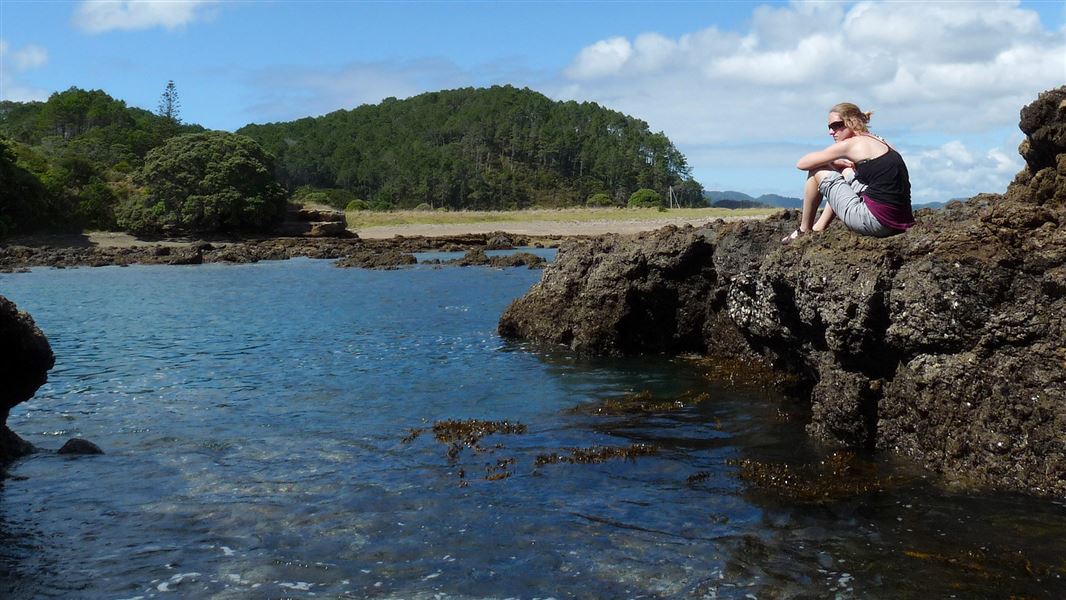
Once out on the water from Paihia or Russell, the first island you see is Motuarohia Island, distinguished by its two glorious lagoons – the most photographed scene in the Bay.
The channel between Motuarohia Island and Moturua Island is a marine mammal safe zone.
The reserve is part of the Bay of Islands Maritime and Historic Park.
- Walks in this area can include sections near steep cliffs. Supervise children when near cliffs and keep on the track at all times.
- Bay of Islands Maritime and Historic Park bylaws apply.
- Rubbish is not collected – take your rubbish with you. There may be rubbish facilities during summer.
- Camping in the Bay of Islands is only available on Urupukapuka Island.
This reserve is within Te Pēwhairangi (Bay of Islands) Marine Mammal Sanctuary.
Water safety
If you plan to enjoy the water, learn how to stay safe when swimming, boating and fishing.
Conservation
In 1979, the central section of the island came under the care of the Department of Conservation.
The island is now pest free, thanks to Project Island Song. As part of an ongoing restoration of the island, whitehead/popokotea have been released. These 'canaries of the forest' can be heard and occasionally seen across Motuarohia. Other conservation work includes looking after resident North Island brown kiwi and NZ dotterel nest protection during the breeding season.
Topography
The topography of Motuarohia ranges from steep coastal cliffs which face the open sea to the north and west, with headlands dissected by moderately steep gullies on its southern side. Flat lat surrounds a lagoon area on the southern side of Motuarohia.
Vegetation
There are kikuyu grass flats, kanuka/native shrub hardwood forest and extensive stands of maritime pine (Pinus pinaster) with a regenerating understorey of native shrub hardwoods which are mainly hangehange and coprosma spp. Coastal cliff communities are extensive with pohutukawa and the coastal tussock (Chionachloa bromoides). Stands of maritime pine were originally grown for the extraction of turpentine.
Extensive planting of native coastal species has resulted in native forest regeneration in areas of felled to waste pine forest on the western end of the island.
Habitation
There are permanent residents on the island in at least one of the 9 dwellings on private land, and there are multiple ancillary buildings.
Public conservation land: Motuarohia Island Recreation Reserve 19.488 ha
Private land: 43.914 ha
Total area: 63.402
Motuarohia Island has several archaeological sites, including defensive pā, terraces, pits, and gardening lines around the central lagoon area. Its many coves have welcomed both Māori and European navigators, and its unique shingle beach connects the two hills of the island.
Māori lived on Motuarohia since early Polynesian settlement, building complex gardens and fortifications. On 29 November 1769, Captain Cook landed on Motuarohia in Cook’s Cove, naming the entire region the ‘Bay of Islands’. French explorer Marion du Fresne visited the island three years later to extract shingle for the ballasts of his two ships.
In 1839, Motuarohia was renamed Roberton Island after John Roberton. Roberton was a former whaling ship captain who purchased the island from Ngāpuhi chiefs Warearahi, Moko and Rewa. A year later, Roberton died in a boating accident, and his wife Elizabeth took over the running of the island.
Over the rest of the 19th century, the island passed through many hands. By the 1950s a private scenic reserve and wildlife refuge had been established on the site. Motuarohia was taken under government care in 1979 and has been a Bay of Islands tourist destination ever since.
Stop kauri disease and protect kauri
- Scrub all soil off shoes and gear.
- Use cleaning stations.
- Always stay on the track.
Check you are pest-free
Check, clean, and seal your gear to ensure you don't bring pests, soil, and seeds.
DOC Customer Service Centre
| Phone: | 0800 275 362 |
| Email: | bayofislands@doc.govt.nz |
| Address: | Pewhairangi / Bay of Islands Office |