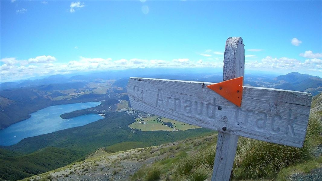
10 km return return via same track
This walk climbs steadily through beech forest to a height of over 1650 metres.
Above the bushline (at 1400 metres) after a 2 hour climb, there are spectacular views from Parachute Rocks, which gained their name from a parachute-shaped gravel scree located just to the north.
The track climbs for a further 30 minutes from here to the ridge line, where you are rewarded by spectacular views of the surrounding area: east down the Wairau Valley, north to Mt Richmond Forest Park, west towards Kahurangi National Park and the Buller Valley, and south to the rest of Nelson Lakes National Park.
Return via the same route.
The track starts in the eastern corner of Kerr Bay, on the edge of Lake Rotoiti in St Arnaud.
St Arnaud is 88 km from Nelson on SH6, 129 km from Picton on SH63, 157 km from Wesport on SH6 and SH63, and 350 km from Christchurh on SH65 and SH6.
- Be prepared with warm and waterproof clothing. Nelson Lakes National Park is in an alpine area – freezing conditions can occur at any time of year.
- No rubbish facilities are provided – carry out all your rubbish.
- Biting sandflies can detract for your experience at the lakes, especially during the summer months – cover up and apply a good quality insect repellant to exposed skin.
- Wasps are a known hazard and are particularly common from December until April – carry antihistamine if you are allergic to their stings.
The lower slopes are dominated by large red beech, with a healthy sub-canopy of other species, such as broadleaf andputaputawētā. Higher up, silver beech and finally the hardy mountain beech take over. Note how the mountain beech becomes progressively stunted as you climb higher to the bushline.
Trees give way to snow tussock, sub-alpine shrubs and, higher still, alpine herb fields. In late spring and early summer, these herbs flower, creating a glorious display of gold and white.
The lower section of the walk crosses moraine terraces deposited by past glaciers. The truncated spurs of St Arnaud Range are evidence of further glacial action at higher altitude. Advancing rivers of icecut off the ends of the ridges and, on the eastern side, gouged out the many small basins where small tarns now fill hollowsleft by the melting ice.
Stay safe in the outdoors
- Choose the right trip for you. Learn about the route and make sure you have the skills for it.
- Understand the weather. Check weather forecasts.
- Pack warm clothes and extra food. Check gear lists.
- Share your plans and take ways to get help. Share directly or use the Outdoor Intentions form or Plan My Walk. Take a distress beacon.
- Take care of yourself and each other.
Nelson Lakes National Park Visitor Centre
| Phone: | +64 3 521 1806 |
| Email: | nelsonlakesvc@doc.govt.nz |
| Address: | View Road St Arnaud 7072 |
| Hours: | Visitor centre hours and services |
Whakatū/Nelson Visitor Centre
| Phone: | +64 3 546 9339 |
| Email: | nelsonvc@doc.govt.nz |
| Address: | Millers Acre/Taha o te Awa 1/37 Halifax Street Nelson 7010 |
| Hours: | Visitor centre hours and services |
