Motueka sandspit is part of the Motueka River delta, which consists of the sandspit, the rivermouth, and the 'Kumaras' estuary. The delta is formed of sediments from the Motueka and Riwaka Rivers, swept into continually changing shapes by the sea.
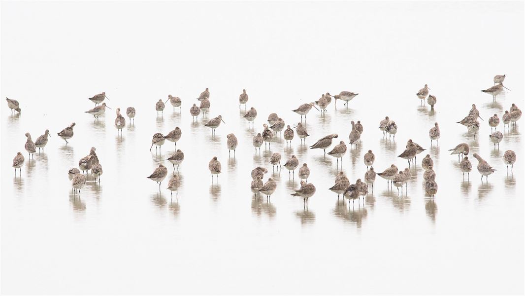
The whole area is ecologically important. It has extensive areas of rushland and saltmarsh where whitebait spawn; it is rich in shellfish and therefore a major feeding ground for wading birds, up to 10,000 of which feed or roost on the sandspit in summer.
This site is considered internationally important under the Ramsar convention for wetlands. This is because of the numbers of bar-tailed godwit, variable oystercatcher, and South Island pied oystercatcher that use the site. Other birds using the site are banded dotterel, ruddy turnstone, terns and gulls.
The sandspit has an all-round view, from D'Urville Island to the Richmond and Arthur ranges and Abel Tasman National Park.
Getting there
Access to the Motueka River delta is at the end of Staples Street, just north of Motueka, or along the foreshore from the old Motueka wharf.
From Staples Street the sandspit separates off from the "mainland" after about 400 m stroll south down the walkway, and from the old Motueka wharf it's closer to 1400 m before you get to the spit's base.
A signpost marks the start of the walk.
Know before you go
Shorebirds, especially godwits, are vulnerable to disturbance. Keep your distance and move away if they appear agitated as you may be near a nest.
Fires, vehicles and horses are not permitted. Horses may be ridden outside the reserve, below the high tide line, taking care not to disturb birds.
Dog access
Dogs are prohibited from the southern section of Motueka Sandspit, south of a point level with Glenaven Drive. Locate the prohibition boundary in Google Maps
In the northern section keep dogs on the wet sand. Don’t let them chase birds.