Dogs with a DOC permit only. Contact closest DOC office to get a permit. Other pets on conservation land rules.
Check road conditions
Severe weather has damaged many roads in Marlborough. Before you travel to our facilities, check the latest road updates on the Marlborough District Council website.
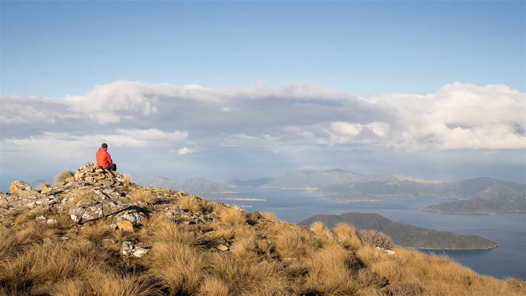
Walk to the the highest point in the Sounds and see a unique sub-alpine habitat with spectacular views.
From Queen Charlotte Drive turn-off at Linkwater onto Kenepuru Road. The start of this track is 41 km from the turn-off at Linkwater. Kenepuru Road is narrow and winding.
- The weather in the Sounds is generally mild, but conditions can change quickly, especially on the water. Ensure that you have adequate equipment and experience.
- This track can experience alpine conditions, including thick fog. Check the weather forecast before you and go. Don't go past the bushline if visibility is poor.
- Light fires only in designated areas.
- Carry water.
- In late summer and autumn, carry antihistamine if allergic to wasp stings.
Mount Stokes is named after Captain John Stokes, who charted the entire New Zealand coastline between 1848 and 1851 in the survey ship Acheron, visiting the Sounds in 1849. The Maori name is Pororangi.
Stay safe in the outdoors
- Choose the right trip for you. Learn about the route and make sure you have the skills for it.
- Understand the weather. Check weather forecasts.
- Pack warm clothes and extra food. Check gear lists.
- Share your plans and take ways to get help. Leave your intentions with a trusted contact and take a distress beacon.
- Take care of yourself and each other.
Nelson/Tasman/Marlborough information
| Phone: | +64 3 546 9339 |
| Email: | nelsonvc@doc.govt.nz |
| About: | Whakatū/Nelson visitor services provide information for this area |