Check road conditions
Severe weather has damaged many roads in Marlborough. Before you travel to our facilities, check the latest road updates on the Marlborough District Council website.
Wakamarina Track is popular with experienced, beginner and family trampers, and mountain bikers. It is an easy weekend trip with an overnight stay at Devils Creek Hut. Mountain bikers could complete the trip in one day. The track is best walked or ridden as described below, from south to north.
It is steep and rough in places, particularly between Devils Creek Hut and Fosters Clearing; boots are recommended.
Kiwi Road to Foster’s Clearing
Time: 2 hr
From the car park on Kiwi Road a well-graded track follows the eastern side of Bartletts Ridge before crossing the head of Bartletts Creek and climbing to the Foster Creek– Bartletts Creek saddle, known as Foster’s Clearing. A short side track leads east up the ridge to Foster’s Hut.
Fosters Clearing to Devil’s Creek Hut
Time: 3 hr
Below Foster’s Clearing the track descends into the head of Foster Creek, skirting around its headwaters and crossing a series of slaty schist creeks. It then climbs to a saddle between Foster and Devil’s Creeks.
From this saddle the track climbs along the Devil’s Creek–Foster Creek ridge and then descends to the benched track of the main Wakamarina Valley. The hut is just five minutes away, in a large clearing on a terrace above the Wakamarina River.
Devil’s Creek Hut to Butchers Flat
Time: 2 hr
From Devil’s Creek Hut a benched track sidles above the river, eventually leaving the beech forest and crossing a burnt-over face to Doom Creek.
A bridge crosses Doom Creek before a short climb up to the benched track that leads to the road end at Butchers Flat.
Side trip: Doom Track
Time: 2 hr return
A good short walk from the Havelock side / Wakamarina/Butchers Flat end of the track.
This wide, benched and historically significant tramping track leaves the main track near Doom Creek. It follows the old water race which delivered water from Foster and Doom Creeks to the quartz crushing battery of the Golden Bar Claim at Deep Creek.
Take care as the track crosses two deep and wide unbridged creeks which are at least knee height. Do not cross during or after heavy rain. There are multiple mine shafts in the bush around the track so do not leave the track or let children or dogs wander off track as there could be unknown shafts. The known ones near the track are fenced.
Mountain biking
Mountain bikers could complete the trip in one day, and it is best ridden from Onamalutu Reserve (Blenheim end) to Canvastown (Havelock end). The section at the Havelock end is a popular shorter ride and is mainly grade 3 to Devils Creek Hut including the Doom Track.
This is a challenging ride with steep sections, particularly during or after wet weather. It is grade 3 (intermediate) to grade 5 (expert). 45 km, 1–2 days. If choosing to spend a night, there is Fosters Hut on the main ridge of the Richmond Range, and Devils Creek Hut in the Wakamarina Valley is around halfway.
This is a shared-use track. Follow the mountain bikers code: respect others, respect the rules, respect the track.
Blenheim side
- Turn off State Highway 6 on to Northbank Road 6 km north of Renwick – 16 km from Blenheim.
- Follow Northbank Road for 5 km, then Onamalutu Road for 11 km
- Continue past Onamalutu Domain, to Flowers Creek ford.
- A final 5 km up Kiwi Road leads to the car park at the start of the track.
Road access is also possible from Bartletts Valley.
Kiwi Road access via Onamalutu to the Wakamarina Track is now open to walkers and bikers only. It is unsafe for vehicles.
Four wheel drive vehicles can still access the Wakamarina Track via Bartletts Road/Bartletts Creek Road.
Before planning to use this access, always check the status of this track.
Havelock side
Access to the track is via Wakamarina Road from Canvastown 9 km west of Havelock on SH6 between Nelson and Blenheim. This road is narrow, winding gravel road. There are also two steep fords near the campsite which are difficult for long campervans, vehicles with long overhangs and caravans.
The section of track from Butchers Flat carpark is no longer accessible to 4WD vehicles. Track users must park at the carpark and either walk or cycle to the track start.
Dogs are allowed in this area with a permit. A maximum of four dogs per party is allowed. Contact the Nelson Visitor Centre for permits.
The track is rough in places and care must be taken.
The weather is changeable, especially at high altitudes, so take warm, waterproof clothing and plenty of food. Remember your safety is your responsibility.
Historic sites remind us of our past. Do not disturb them.
There are multiple mine shafts in the bush around the track so do not leave the track or let children or dogs wander off track as there could be unknown shafts.
Stay safe when crossing rivers and streams
If you plan to cross unbridged rivers or side streams, know how to cross safely and be prepared for if you cannot cross.
Do not cross if the river or stream is flooded, you cannot find safe entry and exit points or are unsure it’s safe. Turn back or wait for the river to drop. If in doubt, stay out.
NIWA river flow forecasts: View a video of national followed by regional river flows
Bird and wildlife watching
Birdlife is varied and abundant and includes large numbers of tomtits and weka. Pigeons and tuis are more common at lower altitudes, while rifleman and brown creepers tend to be more obvious higher up.
Flora and fauna
Tall red and silver beech trees, rimu and kamahi form the forest canopy, with a pepperwood shrub layer and an understorey of dense crown fern. The range of altitudes, particularly on the Wakamarina side, affects temperature, the forest structure and tree size markedly.
You may also see carnivorous native land snail Powelliphanta. These ancient animals feed on worms at night are are themselves eaten by weka and introduced possums and pigs. Powelliphanta are completely protected; it is illegal to remove them or their empty shells which provide a source of all-important calcium for these unique giants.
Mining for gold
Gold was first discovered in the Wakamarina River in 1860. However, it was not under 1864 that it was prospected and found to be one of the richest goldfields in New Zealand.
A number of tent towns sprang up in the valley and by July 1864 there were about 2800 miners working between Doom Creek and Canvastown. By the beginning of 1865 the boom was over and most of the miners had left for other fields.
During the 1930s about 150 miners worked the goldfield, but their number declined sharply after the Depression. More recent attempts (including using diving suits in 1960) have been quite successful in working deeper stretches of the river which were out of the reach of early miners. Today there has been renewed interest in mining and virtually the whole of the Wakamarina River is staked for claims.
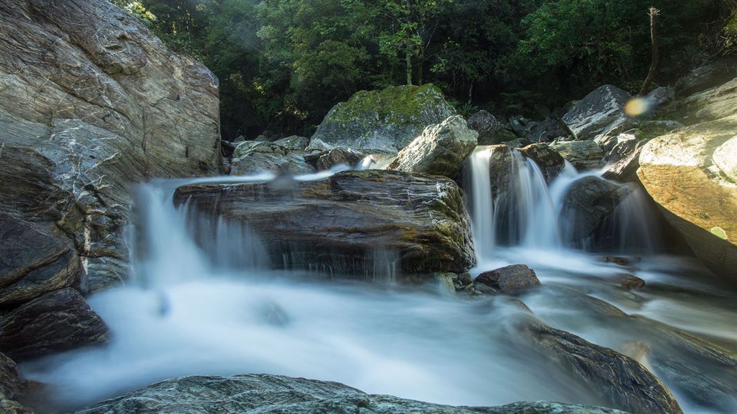
Doom or Dome Creek
Doom, or Dome Creek as it was originally known (from the appearance of the boulders and hills in the area), was very rich in gold. Extensive works were carried out in both branches, although the immense boulders deterred most miners from settling there permanently.
The junction of Doom Creek and the Wakamarina River was known as the Forks and the terrace above the bridge was the site of a small settlement. Little evidence of it remains today, except for isolated stacks of rocks.
Stay safe in the outdoors
- Choose the right trip for you. Learn about the route and make sure you have the skills for it.
- Understand the weather. Check weather forecasts.
- Pack warm clothes and extra food. Check gear lists.
- Share your plans and take ways to get help. Leave your intentions with a trusted contact and take a distress beacon.
- Take care of yourself and each other.
Nelson/Tasman/Marlborough information
| Phone: | +64 3 546 9339 |
| Email: | nelsonvc@doc.govt.nz |
| About: | Whakatū/Nelson visitor services provide information for this area |