2 km return via same track
Acheron Road is open 7 am – 7 pm daily from 1 October to Easter Monday or the second Sunday in April – whichever is later. Acheron Road can close without warning.
Check road conditions
Severe weather has damaged many roads in the Marlborough Sounds. Before you travel to our facilities, check the latest road updates on the Marlborough District Council website.
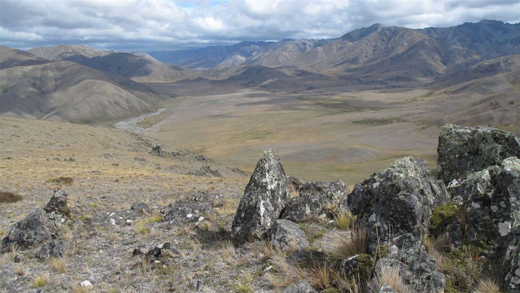
The track starts from a car park at the southern end of Isolated Flat. Parts of the track are unformed, steep, and rough. Follow the ridge to the summit.
The track is marked with poles and is suitable for walkers with good fitness.
From the summit of Mount Augarde there are views north across Isolated Flat and the distant tops of the Severn, Saxton and Acheron Ranges.
Awatere turn-off (22 km/185 km)
From Blenheim, follow State Highway One south, then turn right at the Awatere Valley intersection just north of Seddon and the Awatere Valley Bridge. A sign here will indicate whether the Molesworth Road is open.
Along the public Awatere Valley Road, picnic and toilet facilities are offered at the Marlborough District Council’s Blairich Recreation Reserve (37 km/161 km) and the Hodder Bridge Picnic Area (76 km/132 km).
Molesworth Cob Cottage (122 km/85 km)
For visitors who have travelled up the Awatere Valley, the original cob homestead built by John Murphy in 1866 is the gateway to Molesworth where the Acheron Road begins. If the road is closed, don't go any further.
Nelson Lakes National Park Visitor Centre
| Phone: | +64 3 521 1806 |
| Email: | nelsonlakesvc@doc.govt.nz |
| Address: | View Road St Arnaud 7072 |
| Hours: | Visitor centre hours and services |
Nelson/Tasman/Marlborough information
| Phone: | +64 3 546 9339 |
| Email: | nelsonvc@doc.govt.nz |
| About: | Whakatū/Nelson visitor services provide information for this area |