12.9 km
Makahu Road to Middle Hill Hut
Distance: 4.8 km
Time: 2-3 hrs
The track to Middle Hill Hut begins at the north-west corner of the carpark. Follow the Mangatutunui Stream for 15 minutes.
The track crosses a stream, then climbs and sidles through manuka forest to a plateau. Middle Hill Hut is located in a clearing.
Middle Hill Hut to Kaweka Flats Bivouac
Distance: 5.58 km
Time: 2-3 hrs
Continue along the track from Middle Hill Hut until you reach a track junction. Take the left-hand track (towards Kaweka Flats, not Camp Spur).
The track descends and crosses two tributaries of Koaro Stream, then climbs to a plateau. After crossing the plateau, the track drops steeply into a valley and crosses a branch of the Makehu River. The track then climbs to another plateau.
Shortly after reaching the plateau, there is a side track to Iron Whare.
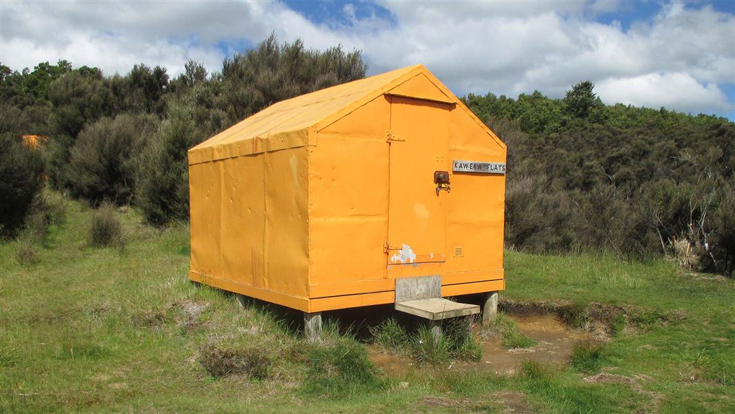
Continue along the main track across Kaweka Flats, to Kaweka Flats Bivvy.
Optional side trip to Iron Whare: There is the option to take a side trip Iron Whare, the oldest hut in Kaweka Forest Park. It was probably built in the 1870s as a musterer’s hut. Read about the history of Iron Whare.
Kaweka Flats Bivvy to Makahu Saddle
Distance: 2.55 km
Time: 1.5 hrs
A benched track leads from Kaweka Flats Bivvy to Makahu Saddle Hut, which is situated 5 minutes from Makahu Saddle car park (at the end of Kaweka Road).
You will need to organise transport from Makahu Saddle to Makahu Road. Makahu Saddle is not on Makahu Road, they are roughly 27 km apart by road (around 50 mins drive).
Be aware of stream crossings on this track
There are multiple unbridged stream and river crossings on this track. They may not be safe to cross, especially during/after heavy rainfall. Assess them carefully before crossing and if in doubt, stay out.
Makahu Road is 75 km north-west of Napier. From Napier follow Puketitiri Road for 40 km before turning right into Pakaututu Road. Makahu Road is 9 km on the left.
At the very end of the road, 500 metres from the Mangatutu Hot Springs and camping area, is "The Gums" parking area and shelter. The tracks to Te Puia Lodge and Mangatainoka Hot Springs begin here. The trip involves about 1 hr of travel on unsealed gravel roads.
The track to Middle Hill Hut is signposted partway along Makahu Road.
There is a river ford on Makahu Road 7.5 km from the road end – heavy rain and snow melt can affect the water level.
Makahu Road is steep and narrow in places. It may be slippery when wet. Take extra caution driving this road. The road is not suitable for caravans or campervans.
Check with Hasting's District Council (external site) for road closures.
Be ready for mountain weather
This is a mountainous area. Visitors should be prepared for sudden weather changes, whiteouts, high winds on the ranges and rapidly rising water levels in rivers and streams.
Check the weather before you go. Kaweka J Summit weather forecast
Pack for all conditions and be ready for weather delays, including with an emergency shelter, spare food and a distress beacon. Packing lists
Stay safe when crossing rivers
If you plan to cross unbridged rivers, know how to cross safely and be prepared for if you cannot cross.
Do not cross if the river is flooded, you cannot find safe entry and exit points or are unsure it’s safe. Turn back or wait for the river to drop. If in doubt, stay out.
Expect a rough, slippery track
This is a backcountry tramping track and it is rough, muddy and slippery (especially after rain). It is best suited to experienced trampers with backcountry skills. You will need sturdy boots with good grip.
Fires
Extreme fire conditions can exist during summer. The park is a restricted fire area, which means permits to light fires are required all year round.
Maps
The Land Information New Zealand (LINZ) topographical maps that cover the Kaweka Forest Park are:
Topo50 map BH36 - Motutere
Topo50 map BH37 - Rangitaiki
Topo50 map BH38 - Te Haroto
Topo50 map BJ36 - Tawake Tohunga
Topo50 map BJ37 - Kuripapango
Topo50 map BJ38 - Te Pohue
Topo50 map BK37 - Tikokino
Stay safe in the outdoors
- Choose the right trip for you. Learn about the route and make sure you have the skills for it.
- Understand the weather. Check weather forecasts.
- Pack warm clothes and extra food. Check gear lists.
- Share your plans and take ways to get help. Share directly or use the Outdoor Intentions form or Plan My Walk. Take a distress beacon.
- Take care of yourself and each other.
DOC Customer Service Centre
| Phone: | 0800 275 362 |
| Email: | napier@doc.govt.nz |
| Address: | Ahuriri / Napier Office |
