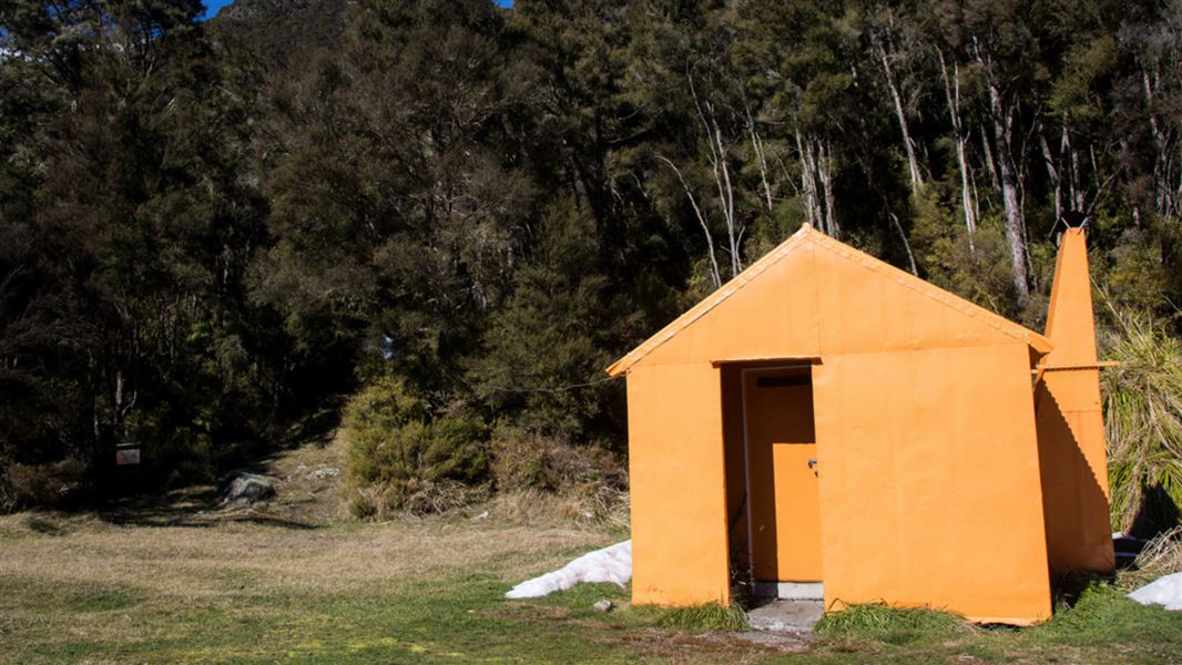
- Creek water supply (Kiwi Creek)
- Open fireplace
- Meat safe
- Long drop style toilet
Kiwi Mouth Hut is an ideal tramping stopover point for access into the southern area of Manson Country and the more remote western areas of the Kaweka Forest Park.
It is located on the western Kaweka Forest Park boundary on the banks of the Ngaruroro River. This is at the foot of the area known as Manson Country.
Built in 1960, this hut has retained its original standard design with an open fireplace. This hut is a comfortable base for many hunting opportunities. At 620 metres altitude, this hut is positioned on a level site close to Kiwi Creek and above the Ngaruroro River. Relatively sheltered from the strong westerly winds common to this area, the hut can experience a wide range of climatic conditions which can include brief snowfalls during cold southerly weather and heavy winter frosts.
Fees
- Adult (18+ years): $10 per night
- Youth (5–17 years): $5 per night
- Child/Infant (0–4 years): free
Before you go, buy 1 Standard Hut Ticket (blue for adults, yellow for youth) for each night's stay. Put this in the honesty box at the hut. Or buy a Backcountry Hut Pass that gives unlimited use at most Standard and Serviced huts for a 12 month period.
About hut tickets and passes | Retailers that sell hut tickets and passes
Helicopter
The helipad is directly in front of the hut. Flight availability and costs can be obtained from helicopter concessionaires in the central North Island.
Walking
Manson Hut (2.5 – 3.5 hr)
From Manson Hut, a marked track heads south along an open ridge passing a high point (1311 metres) and then begins to steadily descend to reach the Ngaruroro River. The river is crossed by a swingbridge to reach Kiwi Mouth Hut (allow 3 – 4 hours for a reverse trip). Caution should be applied to travel in this area, especially the open tops, when poor visibility is often accompanied by high winds and cold temperatures.
Kiwi Saddle Hut (2 – 3 hr)
From Kiwi Saddle Hut there are two approaches – one is much steeper than the other. Both tracks utilise the first portion of a west leading track. After approximately 1 kilometre the track forks. The commonly used track is the right fork that drops down quickly over 400 metres into Kiwi Creek and follows the creek down to Kiwi Mouth Hut.
The other track is used when Kiwi Creek is in flood. This track is longer and is very steep as it descends into the Ngaruroro River valley. During wet weather, the steepness of this track can make for very slippery conditions and caution should be applied to negotiating this track in adverse weather. Some additional time should be allowed (at least 30 minutes) for this track .
Both of the tracks from Kiwi Saddle are also accessed by the track coming north from Cameron Hut. Kiwi Mouth can also be reached from Back Ridge Bivvy (7.3 km to the north of Kiwi Mouth Hut)
Tramping
The location of Kiwi Mouth Hut offers trampers an excellent base or stop-over point. At times of low water flow levels, the Ngaruroro riverbed becomes a pleasant route from the Cameron car-park via Cameron Hut. This 9 km walk takes up to 7 hours. Trampers can continue on to Manson Hut (2.5 – 3.5 hours) which has an initial 2 km steep ascent.
Longer tramps may incorporate ascending the main range from Makahu Saddle and dropping down to Back Ridge Hut and then travelling southwards along Back Ridge to reach Kiwi Mouth Hut.
Tracks to this hut
Location
NZTopo50 map sheet: BJ37
Grid/NZTM2000 coordinates: E1882702, N5641968
Note that all of the land on the true right (west side) of the Ngaruroro River from the Napier-Taihape Road to Kiwi Mouth Hut is held in private Māori ownership.
DOC Customer Service Centre
| Phone: | 0800 275 362 |
| Email: | napier@doc.govt.nz |
| Address: | Ahuriri / Napier Office |
