4.4 km return via same track
Avoid visiting during and immediately after heavy rain due to rockfall risks.
Follow Shine Falls Track through farmland and native forest dominated by kānuka, kawakawa, kōwhai and tītoki.
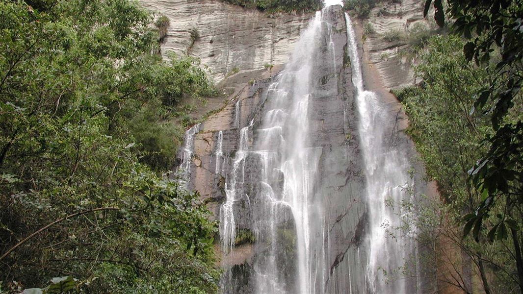
The track follows streams and passes beneath impressive limestone bluffs. It ends at a small viewing area near the base of Shine Falls.
Return along the same track. There is no through-access from Shine Falls to Kamahi Loop as this section of track is closed and unsafe due to cyclone damage.
Cyclone Gabrielle reshaped the landscape in 2023. Visitors may notice changes and see signs of the forest and streams recovering.
Shine Falls Track is near Tūtira, about 55 km north of Napier on State Highway 2.
If travelling north from Napier: Turn onto Matahorua Road by the Tūtira Store and follow the signs to Shine Falls. After about 11 km, turn left onto Heays Access Road and continue to the DOC car park at the track entrance.
If travelling south from Wairoa: Turn onto Matahorua Road at Tūtira, south of Putorino. Follow Matahorua Road then Heays Access Road and the signs to Shine Falls.
What to expect
- Shine Falls Track is a tramping track. There are uneven surfaces and steps.
- The track is mainly flat.
- Sections of the track are close to the stream and waterfall.
- The track is not suitable for wheelchairs.
- No mountain bikes.
When to visit
- There is a risk of falling rocks along the track. Avoid visiting the area during and immediately after heavy rain.
- This area can get very hot in summer. It can snow in winter. There can be high wind, rain and cold temperatures at any time of year. Check the weather forecast before you visit.
Stay safe on the track
- Stay on the marked track and behind barriers. Follow all signs. This is a limestone area and there are caves, shafts and sinkholes off the track. They are unmarked and may be unstable. If you discover an unmarked cave, shaft or sinkhole near a track, stay back and report it to DOC.
- Actively supervise children near the stream, steep terrain and waterfall.
- Rocks near the waterfall and stream can be slippery, as can the whole track in wet weather. Take care around water and avoid climbing the rocks and cliffs.
- There are wasps and ongaonga (native stinging nettle) in this area. We recommend carrying allergy medication and avoiding touching the ongaonga. Report wasp nests and any large ongaonga plants to DOC.
What to take
- Bring a waterproof rain jacket, warm layers, sun protection, sturdy footwear, allergy medication for wasps, drinking water and food.
- Find a full gear list
Farmland
- The track passes through working farmland.
- Respect stock, leave gates as you find them and remain on the formed track.
Facilities and communication
- Mobile phone coverage may be limited in parts of the track.
- Toilets, a picnic area and free car parking are available at the track entrance.
Predator control
- Boundary Stream Mainland Island has extensive predator control. This protects rare native birds like kiwi, kōkako and kākā. Do not disturb traps and bait stations.
- There is a network of predator traps throughout the area, marked by pink and blue triangles. Follow the orange triangles to stay on the walking track.
The track passes through regenerating native forest and provides habitat for a variety of native bird species. Forest species include kānuka, kawakawa, kōwhai and tītoki, while the wider Boundary Stream area is recognised for its significant ecological values and conservation programmes.
Cyclone Gabrielle in 2023 had a big impact on Shine Falls Track. The area experienced significant flooding, erosion and slips that reshaped parts of the valley and waterfall environment.
The track now offers a unique opportunity to experience a landscape that continues to evolve through natural recovery and regeneration. Regenerating vegetation, recovering stream environments and changing habitats are visible throughout the valley.
The waterfall remains a spectacular destination while also standing as a reminder of the resilience of both nature and the communities that have supported its recovery.
Maungaharuru is a significant maunga for local hapū and has strong cultural connections within the area. Māori oral traditions describe the maunga as a place rich in birdlife and spiritual significance.
The area was later incorporated into the Tūtira sheep station, famously documented by Herbert Guthrie-Smith in Tutira: The Story of a New Zealand Sheep Station. In 1976, the Shine family gifted the waterfall and surrounding land, contributing to the establishment of the Boundary Stream Scenic Reserve in 1979.
More recently, Cyclone Gabrielle in 2023 became a defining event in the history of the site, reshaping parts of the valley and waterfall environment and prompting substantial restoration efforts that have enabled visitors to once again experience this iconic Hawke's Bay destination.
DOC Customer Service Centre
| Phone: | 0800 275 362 |
| Email: | napier@doc.govt.nz |
| Address: | Ahuriri / Napier Office |