This area features both a high protection area (HPA) and seafloor protection area (SPA). Make sure you know what you can and can’t do in each of these areas.
New marine protection
19 new marine protected areas are now in place in the Hauraki Gulf/Tīkapa Moana. These areas will contribute to a healthier Gulf for future generations.
Find boundaries and maps on this website and the marine mate app, ask your electronic chart provider or check signs at water entry points.
There are several campgrounds around the Cape Colville area:
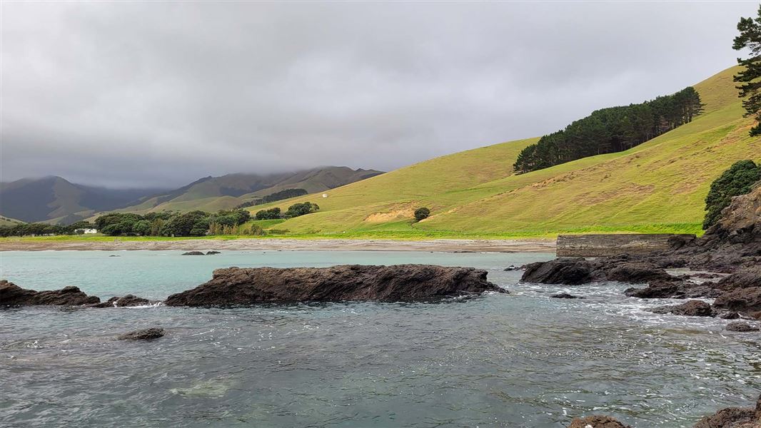
Explore Cape Colville from land. You’ll pass through regenerating native forest, dense bush, farmland and along rocky coastlines with views out to Aotea/Great Barrier Island to the north and Cuvier Island to the east.
85 km north of Thames, Cape Colville is the northernmost point of Coromandel Peninsula, separated from Aotea/Great Barrier Island by Colville Channel.
Boats can launch from various sites, including Port Jackson and Fletcher Bay. Be aware that the waters around Cape Colville can be dangerous and skippers need an excellent understanding of local winds and tides.
View a map and co-ordinates of Cape Colville High Protection Area and Seafloor Protection Area
This area features both a High Protection Area and Seafloor Protection Area.
Make sure you know Hauraki Gulf protection area rules and how you can help preserve this precious ecosystem.
Report illegal or suspicious activity
Don't take, disturb, kill or damage anything within the protection areas. It is illegal. If you see people taking anything from the reserve, report it as soon as possible.
Call 0800 4 POACHER (0800 476 224) or 0800 DOCHOT (0800 362 468).
It is an offence to pollute, litter, discharge fire arms and erect structures.
Report pests
Find-A-Pest lets you report potential pest species, including marine, plant, animal and fungal species.
If you come across something out of the ordinary, upload a picture to the app and a specialist will help identify it. If it's a biosecurity threat, this will be forwarded to Biosecurity New Zealand. If possible, take photos and record the location and name of the vessel.
Or call the Ministry for Primary Industries' Pest and Diseases hotline on 0800 80 99 66.
Prevent pests from spreading
Minimise the spread of pests on land and in water by thoroughly checking and cleaning your boat and gear. Keep your favourite spots pest-free for future generations by following these guidelines:
- clean your hull out of the water before you leave, including the propeller and anchor - see guidelines for hull cleaning
- clean all recreational and boating gear
- if leaving Auckland, check the marine pests website for biodiversity rules for other regions.
Check the marine pests website for more marine biosecurity information.
Fish species you’ll see in the area include:
- blue cod/rāwaru
- goatfish/ahuruhuru
- snapper/tāmure
- red moki
- carlet wrasse/pūwaiwhakarua
- terakihi
- butterfly perch/oia.
The local primary school takes part in a citizen science project monitoring shellfish populations. The students observe what lives in the bay with the aim of documenting changes over time.
Dotterels/tūturiwhatu and variable oyster catchers/tōrea pango nest on the shore here. Dogs must be always kept on a leash.
The Hauraki Gulf Marine Park/Tīkapa Moana/Te Moananui-ā-Toi has a rich history of human settlement. It includes the earliest places settled by Māori.
The area has supported the physical and spiritual wellbeing of mana whenua for centuries. Mana whenua use tikanga/customs that care for and protect the environment when collecting kaimoana/seafood. Mana whenua is the iwi or hapū that has customary authority in an area.
The rugged northern end of Coromandel Peninsula takes its name from the highest peak, Moehau. It is 892 m high. This is the burial place of Tamatekapua, captain of the Arawa canoe.
Early Māori established pā sites along this coast. It was originally known as Te Ūmangawha-o-ngā-waka, meaning The Four Waka. The area provided shelter for waka/canoes when travelling along the coast.
The peninsula and the passage across the channel were later named Colville by Captain James Cook’s after his former naval commander, Lord Colville.
Protection areas
These protection areas began in 2025. They were initiated from the Government response to the Sea Change – Tai Timu Tai Pari Hauraki Gulf Marine Spatial Plan. Sea Change was developed collaboratively by tangata whenua, environmental groups, and the fishing, aquaculture and agriculture sectors of the Hauraki Gulf between 2013 to 2017.
Help high protection areas
- No recreational or commercial fishing.
- No dumping or discharge of waste, sewage or litter.
- Take no more than a handful of shell, sand or driftwood.
- Anchoring is allowed.
- Certain Māori customary practices are allowed.
Some protection areas have exceptions to these rules.
Help seafloor protection areas
- Only low impact fishing is allowed, such as line or spear fishing, harvesting by hand.
- No bottom trawling, dredging, Danish seining.
- No dumping or discharge of waste, sewage or litter.
- Take care when anchoring to avoid damage to the seafloor.
- Set netting, potting and bottom longlining are not allowed in parts of Mokohīnau Islands SPA.
DOC Customer Service Centre
| Phone: | 0800 275 362 |
| Email: | info@doc.govt.nz |
If you see any illegal or suspicious activity, contact the DOC emergency hotline 0800 DOC HOT (0800 362 468).