This is a community trail supported by Ngāti Rangi.
This track is part of the Mountains to Sea Trail – Ngā Ara Tūhono Great Ride (Ngā Haerenga New Zealand Cycle Trails). It connects with the Ohakune Old Coach Road.
12.95 km loop
The track starts next to the Ngāti Rangi office, approximately 100 m lower down the Mountain Road than the Mangawhero Forest Walk and Rimu Walk.
Track highlights include:
- Views of Mt Ruapehu
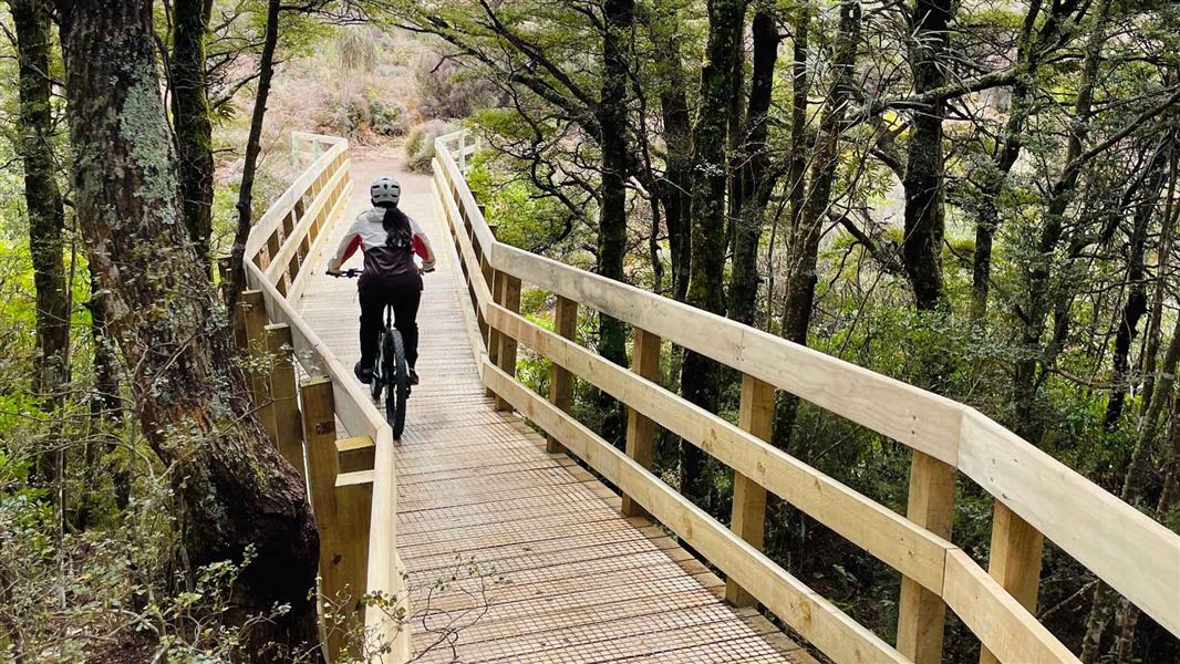
- Bridges spanning the Mangawhero River
- Great track for mountain bike confident families
Phase 2 of the track is still under construction.
The track can be completed in multiple different ways. This track description describes the experience riding from the start of the track, to the top of Phase 1 and the campground loop section.
The overall track climb is 262 m.
Uphill climb to campground loop junction
Distance: 4.2 km one way from start of track to the campground loop track junction
The track climbs through the national park until it meets the Mangawhero Forest Walk. Continue up the track until you reach a track junction sign posted for Tūroa. Turn left and continue up the track through the understory of ferns as you gently climb to the road crossing.
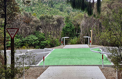
One of the road crossings on Te Ara Mangawhero. Cyclists and walkers need to give way to road traffic.
Take extra care at the road crossing. This is a busy public road with traffic travelling at 80 km/h. Look and listen for approaching traffic before crossing.
The track continues up via the historic tramways and crosses the Mangawhero River. From the bridge, there is a short ride to the campground loop track junction.
Climb to the end of Phase 1
Distance: 2.5 km one way from campground loop junction to the end of the Phase 1 track
From the campground loop junction continue up the track to the end of Phase 1. From the end of the track, you need to turn around to return the way you came.
There is no access from the top of the track to the Ohakune Mountain Road. That will come in Phase 2.
Campground loop section
Distance: 2 km track junction to Ohakune Mountain Road
From the campground loop track junction the track is mostly a descent with some small, steep uphill sections.
The track eventually joins the campground road and passes the Mangawhero Campsite. Watch for vehicles through this section and follow road rules, keeping left. Follow the campground road to the road junction with the Ohakune Mountain Road.
Cross the road and head back into the bush. Then follow the track until you reach the track junction sign posted for Ohakune (approx 300 m).
Note: The track is a shared use track. Keep in control and expect uphill bikers or walkers at all times.
The track starts next to the Ngāti Rangi office at the base of the Ohakune Mountain Road.
From Ohakune township follow signage for Tūroa Ski Area for 2 km. The carpark is located on the left before Ohakune Mountain Road continues into the forest.
The track crosses a public road
The track crosses a public road in an 80 km zone. Expect a lot of traffic on this road, especially during winter when the Turoa Ski Field is open.
Take extra care to cross safely. There are barriers and markings on the road to alert both cyclists and drivers to the hazard.
Expect a shared use track with uneven surfaces
Te Ara Mangawhero is a walking track and a Grade 2 mountain biking trail. Expect to encounter walkers and cyclists going in both directions, so go slowly on blind corners and respect other track users.
The track is gravel and can be slippery in some areas. Especially corners as you approach bridges. There are steep sections, narrow bits of track and tight corners. If you are biking, you will need a mountain bike (or mountain e-bike) in good working order – a road bike isn’t suitable for this track.
Part of the campsite loop shares the track with vehicles including campers. Take extra care on this section.
Take extra care - you are biking in a remote area
Take extra care when biking the uneven sections of track. If you get hurt, help can take a long time to reach you as access to parts of the track can be difficult.
In the event of an emergency, track markers will help emergency services locate you. There are KM markers placed along the track at every kilometre. Should you have an accident, report the nearest KM marker number as reference of your location in your 111 call.
Carry a PLB and a charged mobile phone. Mobile phone reception is available on most of the track.
The neighbouring track network is for walking only
There are several tracks that connect to the Te Ara Mangawhero that are walking only. Take note of the signs at place. All tracks are well marked.
 No unauthorised drone use in the national park
Unauthorised use of drones is prohibited. You must have a permit to fly a drone.
DOC does not generally approve permits to fly drones in this national park and we do not recommend you apply for one.
The track is rich in cultural and natural history. Read about this on the Mountain to Seas website.
Stay safe in the outdoors
- Choose the right trip for you. Learn about the route and make sure you have the skills for it.
- Understand the weather. Check weather forecasts.
- Pack warm clothes and extra food. Check gear lists.
- Share your plans and take ways to get help. Leave your intentions with a trusted contact and take a distress beacon.
- Take care of yourself and each other.
Tongariro National Park Visitor Centre
| Phone: | +64 7 892 3729 |
| Email: | tongarirovc@doc.govt.nz |
| Address: | Whakapapa Village State Highway 48 Mount Ruapehu 3951 |
| Hours: | Visitor centre hours and services |