11 km return return via same track
The track begins with an easy 20 minute walk to the Taranaki Lookout with a view towards Mt Taranaki, and views back to Mt Ruapehu and Hauhungatahi.
From this point the track becomes more rugged, suitable for more experienced walkers. The track follows a ridge and then descends steeply about 230 m down to a stream. Conditions can be slippery / muddy following rain.
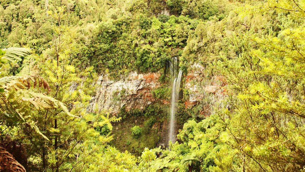
Tupapakurua Falls plummet to the valley floor in splendid isolation, amidst regenerating podocarp forest. There is a wonderful diversity of plant and tree species with good stands of tawa, mature rimu, miro and totara.
Climbing back up from the stream, the track winds its way around bluffs with beautiful forest views and good lookout points to the waterfalls.
Return via the same track.
This old Forest Service track was upgraded by the local community in partnership with DOC, adding a wonderful forest walk to the region.
DOC maintains the track to the lookout but not to the falls.
Begins at Fishers Road, Waimarino (formerly National Park Village). Either walk from the village up Fishers Road to the beginning of the track itself (30 min), or drive up Fishers Road to the parking area.
Stay safe in the outdoors
- Choose the right trip for you. Learn about the route and make sure you have the skills for it.
- Understand the weather. Check weather forecasts.
- Pack warm clothes and extra food. Check gear lists.
- Share your plans and take ways to get help. Leave your intentions with a trusted contact and take a distress beacon.
- Take care of yourself and each other.
Tongariro National Park Visitor Centre
| Phone: | +64 7 892 3729 |
| Email: | tongarirovc@doc.govt.nz |
| Address: | Whakapapa Village State Highway 48 Mount Ruapehu 3951 |
| Hours: | Visitor centre hours and services |