Image gallery
Little Mt Peel/Huatekerekere via Deer Spur
Time: 2–3 hr one way
Distance: 4.6 km one way
From the car park at Blandswood, walk up the steep Blandswood Lookout Road to the top. Follow Fern Walk for about 350 m before turning left onto Deer Spur Track. The track follows a ridge up to the summit (1311 m).
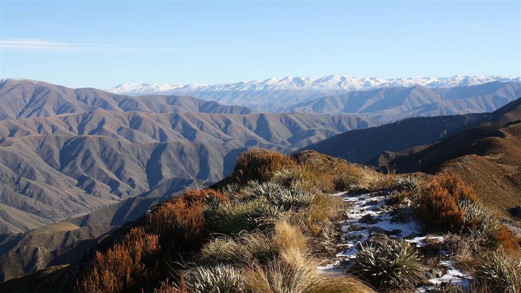
There are magnificent views of Mt Somers, Mt Hutt and across the plains to the coast. Tristam Harper Memorial Shelter is just below the summit.
This track has steep sections and wooden boardwalks. These can be slippery when wet or icy. We recommend wearing hiking boots so you don’t slip.
Little Mt Peel/Huatekerekere via South Ridge Track
Time: 3 hr 30 min one way
Distance: 3.5 km one way
An alternative to climbing or descending Little MtPeel/Huatekerekere from Deer Spur is to use the South Ridge Track. The South Ridge is steep and involves a couple of rocky scrambles.
South Ridge Track connects with Deer Spur at the top of the mountain and Emily Falls Track near the bottom.
When descending from Little Mt Peel/Huatekerekere keep to the ridge until the track sign shows the route down a tussock-covered spur to the bushline and Emily Stream.
9.5 km north of Geraldine, turn off SH72 (Inland Scenic Route) onto Peel Forest Road and follow this for 13 km. Turn into Blandswood Road and follow this for 2 km to the junction with Lookout Road. Park in the car park at the junction.
Walk a short distance up Lookout Road to the start. Note, Lookout Road isn't suitable for parking.
Cellphone coverage in Peel Forest area is poor.
Weather
These are alpine summits and the weather can be very different from at road level – take appropriate clothing and equipment.
This track has steep sections and wooden boardwalks. These can be slippery when wet or icy. We recommend wearing hiking boots so you don’t slip.
Stay safe in the outdoors
- Choose the right trip for you. Learn about the route and make sure you have the skills for it.
- Understand the weather. Check weather forecasts.
- Pack warm clothes and extra food. Check gear lists.
- Share your plans and take ways to get help. Leave your intentions with a trusted contact and take a distress beacon.
- Take care of yourself and each other.
DOC Customer Service Centre
| Phone: | 0800 275 362 |
| Email: | info@doc.govt.nz |