Coopers Creek car park to Ryde Falls (Ryde Falls Track)
Time: 3 hr one way
Distance: 7 km one way
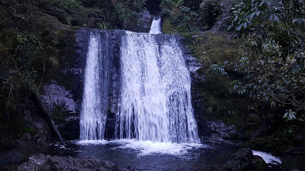
This well-formed track initially crosses cleared private land with views of the plains and surrounding hills. It enters the beech forest and finally descends to Coopers Creek to view the five-tier Ryde Falls.
A panel by the, now closed, Ryde Tramway tells of the area’s rich saw milling history.
Getting there:
2 km south of Oxford, turn off SH72 (Inland Scenic Route) onto Woodside Road. Follow this for 7 km, then turn into Mountain Road and continue to Coopers Creek car park at the end.
View Hill car park to Ryde Falls
Time: 1–2 hr one way
Distance: 3 km one way
Leave the car park on Wharefedale Track. Turn off this track about 20 minutes into the forest and descend to Coopers Creek to view Ryde Falls.
Getting there:
4 km south of Oxford, turn off SH72 (Inland Scenic Route) onto Woodstock Road. Follow this for 10 km then turn into Ingrams Road, then into Limeworks Road, which becomes Perhams Road. An AA sign here indicates the turn-off to the start of the Wharfedale Track where the View Hill car park is located.
In times of heavy rain two fords on Perhams Road may become impassable and the road may be muddy. 4WD vehicles are advisable.
Link Track
Use this track to make a circuit walk to Ryde Falls from either View Hill or Cooper Creek car park.
You can also walk between View Hill and Cooper Creek car parks on this track (3 hr, 7 km).
These tracks are accessed from SH72 (Inland Scenic Route), just south of Oxford.
Access to Coopers Creek car park to Ryde Falls (Ryde Falls Track)
2 km south of Oxford, turn off SH72 (Inland Scenic Route) onto Woodside Road. Follow this for 7 km, then turn into Mountain Road and continue to Coopers Creek car park at the end.
Access to View Hill car park to Ryde Falls
4 km south of Oxford, turn off SH72 (Inland Scenic Route) onto Woodstock Road. Follow this for 10 km then turn into Ingrams Road, then into Limeworks Road, which becomes Perhams Road. An AA sign here indicates the turn-off to the start of the Wharfedale Track where the View Hill car park is located.
In times of heavy rain two fords on Perhams Road may become impassable and the road may be muddy. 4WD vehicles are advisable.
- You will need to cross the creek to reach the waterfall viewpoint. This can be uncrossable during and after heavy rain.
- The track can be muddy after rain. It is also narrow and can be slippery near the waterfall viewpoint. Take care, especially with children.
Wasp warning
Wasp populations reach high numbers from January to April – wear light-coloured clothing and carry antihistamine cream/tablets as a precaution.
Stay safe in the outdoors
- Choose the right trip for you. Learn about the route and make sure you have the skills for it.
- Understand the weather. Check weather forecasts.
- Pack warm clothes and extra food. Check gear lists.
- Share your plans and take ways to get help. Leave your intentions with a trusted contact and take a distress beacon.
- Take care of yourself and each other.
Arthur's Pass National Park Visitor Centre
| Phone: | +64 3 318 9211 |
| Email: | arthurspassvc@doc.govt.nz |
| Address: | 104 West Coast Road Arthur's Pass 7654 |
| Hours: | Visitor centre hours and services |