4.5 km
Image gallery
Video
All walks start from the main ferry jetty.
Ōtamahua/Quail Island Loop Track (full island circuit)
Time: 2 hr 30 min loop
Distance: 4.5 km loop
This walk around the island passes the front of the Ōtamahua Hut, through open grassland and along the basalt cliffs to the Ward brothers’ old cottage site. From here it leads to the northern point of the island and the bird observation barricade. Views extend down the harbour and across to Rapaki.
Turn south-west and skirt the stock dam to reach a vantage point for an excellent view of the ships’ graveyard, which contains wrecks of at least 14 scuttled ships offshore.
Continue along to the southern-most point of the island above Walkers Beach and past the quarry workings. The grave of Ivon Skelton, one of the leprosy sufferers that died on the island, is found here.
Around the point the track turns north to the terraces behind the skiers’ beach where the leprosy colony buildings once stood. View the replica cottage (built by students of Catholic Cathedral College) and walk past the stone terraces, admiring the craftsmanship of early 20th century prisoners from Lyttelton Jail. Turn left to climb a short distance to the dog kennels site; a replica of these has also been built by the students.
Return to the main track on the same path back down towards Whakamaru Beach and continue to the quarantine barracks. Walk around the beachfront, past the remains of the historic stock jetty and back to the ferry jetty.
Whakamaru Beach (Swimmers beach)
Time: 5 min one way
Distance: 400 m one way
Although the track from the ferry jetty is a bit steep, it’s worth the climb down to the beach, and the track surface is suitable for baby buggies. The beach is a safe place for swimming and the bay is reasonably sheltered. It is a great spot to pause, have a picnic lunch, fossick among the rocks or beach-comb for shells and seaweed to decorate a sand sculpture.
Summit Track
Time: 15 min one way
Distance 700 m from Ōtamahua Hut
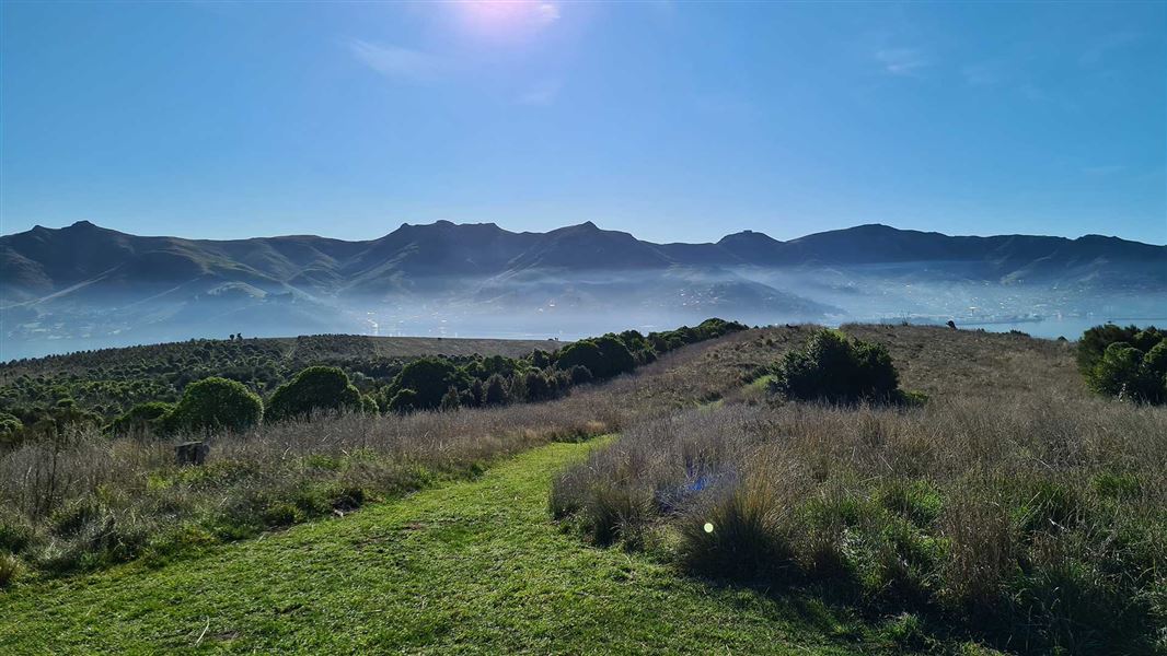
From the Ōtamahua Hut, walk the old tractor path as it gently climbs towards the highest point on the island. You will pass through a large area of replanting, the work of the Quail Island Ecological Restoration Trust. At the summit, enjoy panoramic views of the surrounding low mountains and Lyttelton Harbour. The Summit Track can also be reached from Whakamaru Beach via the Dog Kennel Track.
Dog Kennel Track
Time: 10 min one way
Distance: 300 m from Whakamaru Beach
This track gives access to the replica dog kennels historic site, and is also a shortcut across the island.
Ōtamahua/Quail Island lies within Whakaraupō/Lyttelton Harbour, close to Christchurch City.
There is a regular ferry service from Lyttelton Wharf. Ensure you know when the last ferry leaves Quail Island to get back to Lyttelton. Black Cat Cruises schedule and fees.
Alternatively, you can make your own way to the Island by canoe, kayak or private boat.
Whakamaru (Swimmers) beach, Skiers Beach or Walkers Beach are the recommended places to land/launch canoes or kayaks. There is also plenty of room to pull up a boat. Care is required as these areas will be shallow or mud flats at low tide. The majority of the island’s coast is unsuitable for landings. Check the weather forecast before you leave for the island.
The wharf is not suitable for overnight mooring.
- Toilets are located at Ōtamahua Hut, Whakamaru Beach (Swimmers Beach) and Skiers Beach.
- Boil water before use.
- Most track surfaces on the Island are evenly graded or grassed, but sturdy footwear is recommended.
- The Island contains a number of unmarked tracks used by the Ōtamahua / Quail Island Ecological Restoration Trust for planting access - stay on sign-marked tracks to avoid stepping on new plants and for your own personal safety.
- Carry adequate clothing and be prepared for sudden changes in the weather – parts of the Island are exposed.
- There are steep unfenced cliffs. Small children should be kept under close supervision at all times.
- There is a danger of windfall or treefall in high or gusty wind conditions.
- Mobile reception is available on the island.
- The wharf is not suitable for overnight mooring.
Ōtamahua/Quail Island is at times subject to extreme fire danger
If fire breaks out on the Island:
- head to the nearest beach or coastal area, if it is safe to do so.
- if you have a mobile, dial 111 for fire.
Look after the island
- No open fires
- No animals, including dogs
- No unauthorised vehicles, including mountain bikes
- No firearms
- No drones
- All wildlife, plants, and natural and historic features are protected. Be respectful and keep to the tracks.
- Take home all your rubbish.
- Bait stations and predator traps are in use at all time. Read the warning signs on the wharf and around the Island.
Protect our wildlife
- Check - your gear for pests, eg rodents, insects, skinks.
- Clean - footwear and gear, removing soil and seeds.
Check you are pest-free
Check, clean, and seal your gear to ensure you don't bring pests, soil, and seeds.
Arthur's Pass National Park Visitor Centre
| Phone: | +64 3 318 9211 |
| Email: | arthurspassvc@doc.govt.nz |
| Address: | 104 West Coast Road Arthur's Pass 7654 |
| Hours: | Visitor centre hours and services |