- The Wairepo Kettleholes protects a fascinating wetland environment covering approximately 400 hectares.
- Located in the Mackenzie Basin, in the central South Island, the closest township is Omarama.
- The area became public conservation land when Glen Eyrie Downs Station completed the tenure review process in 2004.
The public entry point to the Wairepo Kettleholes is 14 km along Quailburn Road and is well sign-posted (Quailburn Road starts approximately 4 km north of Omarama township off State Highway 8).
There is ample room for off-road parking. Access is via an easement which follows an old farm track to the kettleholes; return the same way. The forested area on the eastern side of this easement is private land.
At the end of Quailburn Road is the Quailburn historic area which is part of the Ahuriri Conservation Park. This area is suitable for picnics and walking.
The land within the conservation area is made up of thick deposits of moraine and outwash gravel formed down valley of the Ohau glacier, which was present over 10,000 years ago. The result is gently rolling hummocks of moraine and a series of depressions which are sometimes filled with water.
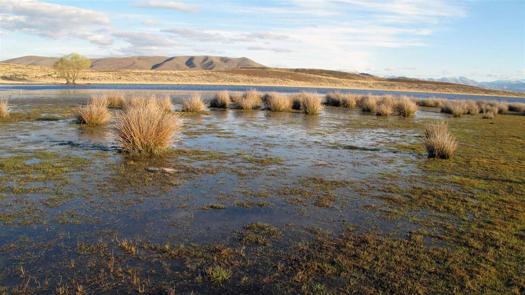
The kettleholes
These ponds or kettleholes gradually dry out over summer, to reveal a rich plant-life of very small herbs, which form a dense turf around the wetland margins.
While the kettleholes have water in them, they are an important feeding area for a number of key bird species such as black stilt/kakī, wrybill/ngutuparore, black-fronted tern/tarapirohe, shoveller duck/kuruwhengi and a host of other wading and wetland birds. It is also an important refuge area for these birds when the Ahuriri River is in flood.
Also in the conservation area are fragmented patches of red tussock, sedges and rushes along the margins of Wairepo Creek, a stream containing a number of freshwater fish and invertebrates.
Aoraki/Mount Cook National Park Visitor Centre
| Phone: | +64 3 435 1186 |
| Email: | mtcookvc@doc.govt.nz |
| Address: | 1 Larch Grove Aoraki/Mount Cook 7999 |
| Hours: | Visitor centre hours and services |