Image gallery
Video
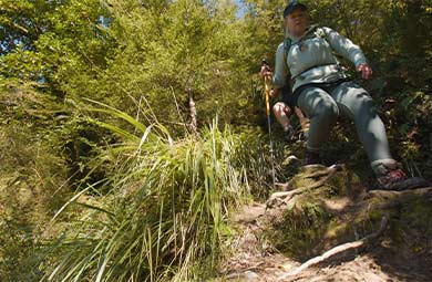
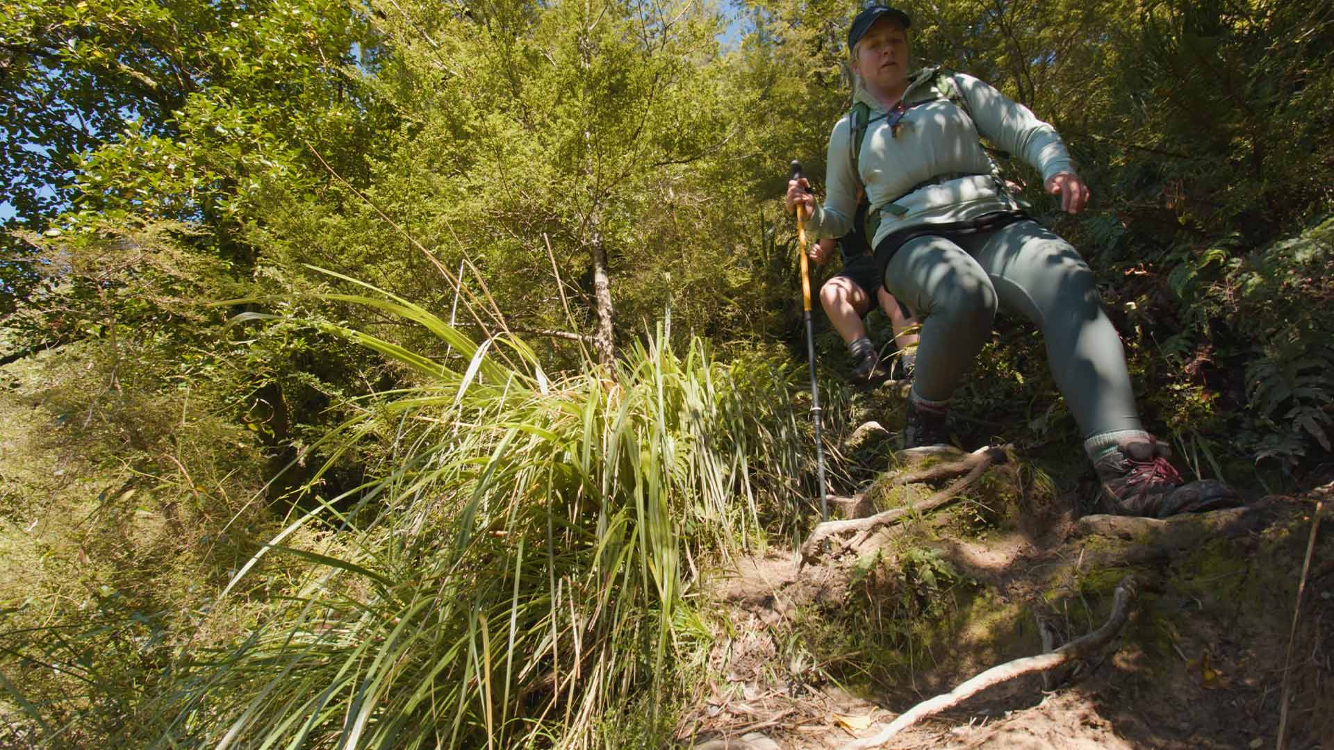
The track from Sharplin Falls car park to Pinnacles Hut is considerably more challenging than most other tramping tracks in the Te Kiekie/Mount Somers area. Take care and allow extra time. The track from Woolshed Creek car park to Woolshed Creek Hut is an easier alternative.
Streams in the area, particularly Pony Stream on the way to Pinnacles Hut, can rise quickly after heavy rainfall and become dangerous and impassable.
Walking options
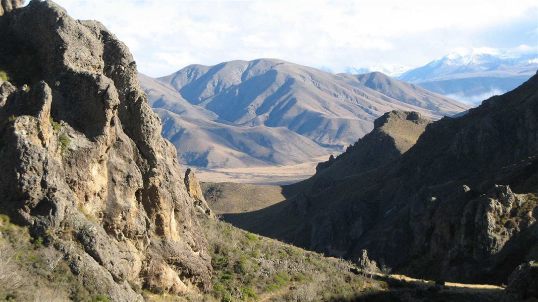
There are rough and rugged sections of track. View larger image (JPG, 263K). Image: New Zealand Mountain Safety Council
Mount Somers Track runs from the Sharplin Falls car park to the Woolshed Creek car park along the northern side of Mount Somers. There are two huts on the track – Woolshed Creek and Pinnacles. The track is a two-day tramp suitable for families.
You can also do an overnight return tramp on the track, either from Woolshed Creek car park to Woolshed Creek Hut (an easier option) or from Sharplin Falls car park to Pinnacles Hut (a much more challenging option).
You can combine Mount Somers Track with the Bus Stop Track and South Face Track to make a circuit. This circuit starts and ends at Sharplin Falls car park. This is more challenging than the main Mount Somers Track. See further information further down this page.
This area gets very cold in winter and early spring. There can be snow and ice. It is best suited to experienced and well-equipped trampers at these times. Trampers with less experience are advised to choose the return overnight trip to Woolshed Creek Hut in winter, rather than the full track.
Sharplin Falls car park to Pinnacles Hut
Time: 3.5 hr
Distance: 5.8 km
The track climbs steeply through mountain beech forest/tawhairauriki to Dukes Knob before following Bowyers Stream to Pinnacles Hut.
Allow more time if your group is not used to tramping. There are steep and rough sections of the track, including places where you will need to scramble over tree roots and places with steep drops beside the track. Supervise children through tricky or technical sections.
Heavy rain can flood the streams on this track and make them impassable, particularly Pony Stream. Assess them carefully before crossing. If heavy rain is forecast, consider changing your plans.
The hut is named after the rock formations on the northern face of Mount Somers, formed by the cooling of very hot sticky lava flows some 90 million years ago.
Pinnacles Hut to Woolshed Creek Hut
Time: 3 hr
Distance: 6.2 km
From the hut, follow markers through tussock and subalpine scrub up to the Mount Somers saddle (1170 m). It's a steady climb to the saddle where views of the Mount Somers Range and Old Man ranges dominate the scenery.
On the descent towards Morgan Stream, a sign indicates a short side-trip to view some interesting boulder features referred to as ‘caves’. Follow the markers across Morgan Stream and Woolshed Creek to Woolshed Creek Hut. There are no bridges, so assess these streams carefully before crossing – they may not be safely crossable.
Woolshed Creek Hut to Woolshed Creek car park
Time: 2 hr 30 min
Distance: 5.1 km
From Woolshed Creek Hut, the track rises to a high point (trig R, 934 m) with superb views of the upper Ashburton Gorge, before descending to the old Blackburn Mine. The track then runs alongside the hand-built jig that transported coal from the Blackburn Mine to the railway wagons waiting below. At the bottom of the jig the track follows the route of the tramway to Woolshed Creek car park.
Alternative route: 4WD track
From Woolshed Creek Hut, you can follow a 4WD track to its junction with the Mt Somers Track below Trig R. This is an easier track but takes about the same time.
Alternative route: Sidewinder Track
Time: 45 min
Distance: 1 km
This steep hill track branches off the Mount Somers Track. It starts at Blackburn Mine, then descends steeply into Woolshed Creek valley. It ends with a short walk through a silver beech forest before rejoining Mt Somers Track. Taking the Sidewinder Track adds about 25 minutes to the time out from Woolshed Creek Hut compared to the using The Mt Somers Track the whole way.
Alternative exit route: Woolshed Creek Hut to Woolshed Creek car park via Bus Stop and South Face Tracks
Category: Advanced tramping track
Time: 3 hr
Distance: 6.4 km
This is an alternative route for the last day of the Mount Somers Track. It is more challenging than Mount Somers Track.
From Woolshed Creek Hut, the track climbs some 500 metres to a local feature known as the Bus Stop Overhang. From here, the track crosses the face of Mount Somers to link with South Face Track (2 hr from the track start), which then follows a rocky ridge to Woolshed Creek car park.
There is dynamic scenery with regenerating mountain beech forest/tawhairauriki within a landscape of waterfalls, deep icy pools and rocky tors.
Circuit option: Returning to Sharplin Falls car park via Bus Stop Track and South Face Track
You can combine the Bus Stop Track and South Face Track with Mount Somers Track to make a circuit, starting and ending at Sharplin Falls car park. This is longer and more challenging than the Mount Somers Track, and there can be persistent snow in winter and spring.
For the circuit, follow Mount Somers Track to Woolshed Creek Hut, as described above. Then take the alternative route described below to loop back to Sharplin Falls car park.
Woolshed Creek Hut to Sharplin Falls car park
Category: Advanced tramping track
Time: 8 hr
Distance: 14 km
From the hut, the route climbs some 500 m to a local feature known as the Bus Stop Overhang. From here the track crosses the face of Mount Somers to link with South Face Track.
Continue around the southern face of Mount Somers on the South Face Track, through a mix of open grassland and forested catchments. You pass Acland Shelter, a good place to stop for a rest but not intended to be used overnight. This section of track eventually rises to its highest point (1080 m) at the junction of the Mount Somers Summit Track.
The final steep downhill section is through regenerating forest areas but is open enough to continue to provide interesting views to the east.
In winter, the south face of Mount Somers gets very little sunlight, making the snow hard and icy. An ice axe, crampons and some mountaineering experience are required to safely reach the summit. The summit of Mount Somers is very exposed to southerly fronts.
Understand if you are ready for Mt Somers tracks
Watch the NZ Mountain Safety Council’s walk-through video which takes you through how to prepare for the tracks on Mount Somers, including this track. It explains the facilities, key decision points, hazards and typical conditions for the area.
Sharplin Falls car park: Sharplin Falls car park is at the end of Flynns Road, Staveley.
Woolshed Creek car park: From Mount Somers township, follow Ashburton Gorge Road for approximately 10 km before turning right into Jig Road. Follow Jig Road to the end.
If you intend to walk only one way from Woolshed Creek car park and require vehicle transport, a local service is available, phone Marilyn Gray on +64 3 303 0809 before you start your trip.
Be ready for all weather
The Mount Somers area is an alpine environment and bad weather can occur at any time of the year. The area can be extremely hot and dry, and at others times can experience freezing cold, high winds, heavy rain and snow.
There is no tree cover on parts of the track and you are fully exposed to the weather.
Always bring warm, waterproof layers, sturdy footwear and sun protection.
Check the Mount Somers Track weather forecast
Pack well for your trip
Overnight and multi-day packing list for tramping
Use NZTopo50 map sheets BX19 and BX20. We recommend carrying a distress beacon.
Expect snow and challenging alpine conditions in winter
There can be deep snow and ice on Mount Somers Track in winter. At that time of year, Mount Somers Track is a trip best suited to experienced and well-equipped trampers, with the skills and gear to safely tramp in snow.
In winter, the south face of Mount Somers gets very little sunlight, making the snow hard and icy. The south face and summit tracks can have persistent snow and ice in winter and spring. The best time to attempt these tracks is from November to April.
An ice axe, crampons and some mountaineering experience are required to safely reach the summit from May to October. The summit of Mount Somers is very exposed to southerly fronts.
There are wasps
Wasps may be present in high numbers, particularly during summer. Consider carrying an antihistamine product and if you are allergic to stings, ensure you bring your medication.
Stay safe when crossing rivers and streams
If you plan to cross unbridged rivers or side streams, know how to cross safely and be prepared for if you cannot cross.
Do not cross if the river or stream is flooded, you cannot find safe entry and exit points or are unsure it’s safe. Turn back or wait for the river to drop. If in doubt, stay out.
NIWA river flow forecasts: View a video of national followed by regional river flows
Nature's in trouble
Thousands of New Zealand’s native species are heading towards extinction. Once they’re gone, they’re gone for good. Nature needs your help.
Stay safe in the outdoors
- Choose the right trip for you. Learn about the route and make sure you have the skills for it.
- Understand the weather. Check weather forecasts.
- Pack warm clothes and extra food. Check gear lists.
- Share your plans and take ways to get help. Leave your intentions with a trusted contact and take a distress beacon.
- Take care of yourself and each other.
DOC Customer Service Centre
| Phone: | 0800 275 362 |
| Email: | info@doc.govt.nz |