3.1 km one way
An old farm track starts alongside State Highway 73, at the Starvation Gully car park halfway between Porters Pass summit and Lake Lyndon.
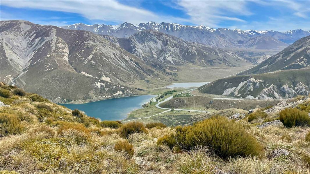
Climb up the track amongst diverse shrublands, traversing open ridges to trig point M above Lake Lyndon. This route provides great panoramic views.
You can return the same way, or follow the Coach Stream Route from about half way along the Trig M Route. The Coach Stream Route finishes at the bottom of Porters Pass, approximately 4 km from the Starvation Gully carpark. It is best if you have two cars, one in each car park, as walking is not recommended between these carparks.
Side trip: Rabbit Hill
Time: 3–4 hr
Follow the ridgeline from Trig M to Rabbit Hill. This passes through a tussock basin just before the final ascent to the summit of Rabbit Hill. There are numerous springs in this area and it can be very wet underfoot.
The Trig M Route begins at the Starvation Gully carpark on SH73, between the top of Porters Pass and Lake Lyndon.
This route is unmarked and suitable for fit, experienced and well-equipped people.
Winter snow and ice could make these routes difficult and dangerous.
NZTopo50 map BW21 (Springfield) covers this area.
Times are approximate and one way.
Stay safe in the outdoors
- Choose the right trip for you. Learn about the route and make sure you have the skills for it.
- Understand the weather. Check weather forecasts.
- Pack warm clothes and extra food. Check gear lists.
- Share your plans and take ways to get help. Leave your intentions with a trusted contact and take a distress beacon.
- Take care of yourself and each other.
Arthur's Pass National Park Visitor Centre
| Phone: | +64 3 318 9211 |
| Email: | arthurspassvc@doc.govt.nz |
| Address: | 104 West Coast Road Arthur's Pass 7654 |
| Hours: | Visitor centre hours and services |