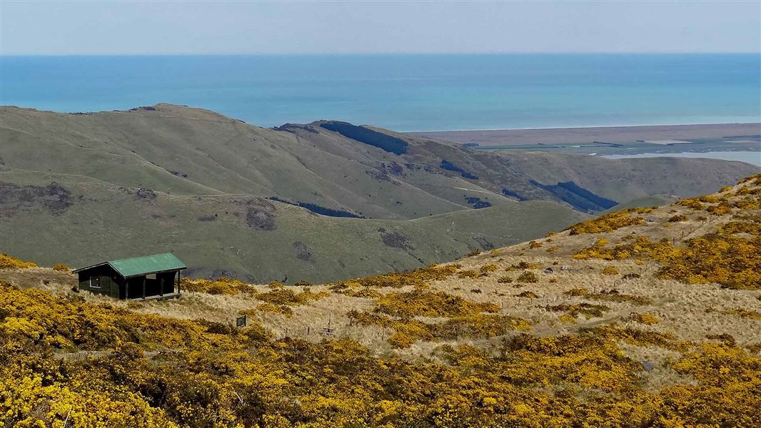
14 km return via same track
Closed for lambing from 8 August to 15 October.
Track to summit
The track starts from the Te Waipapa/Diamond Harbour wharf. If driving from Christchurch there is good parking in the small village above. Alternatively take the ferry across the harbour from Lyttelton to the wharf. From the wharf follow the road up towards the Village. After a few minutes walking a track leads off to the right, soon dropping down to the beach.
From the end of the beach, a rough track heads directly uphill, following a creek bed through pine forest and regenerating bush. Ignore any side tracks and follow the main trail up the creek. After crossing Marine Drive at a bend, turn right for the start of the next section. The track enters scrubby farmland, soon passing a large historic eucalyptus tree, believed to have been planted by the early European settler Mark Stoddart in the 1860s.
Cross the unsealed Bayview Road and veer slightly left to pick up the track again. This is last place within Diamond Harbour you could start the track, cutting about 30 minutes off your walking time.
The track climbs into farmland and passes the remains of a pioneer’s cob cottage. Mature gum trees planted here form a large square, outlining an overgrown garden. The vegetation from here on up is a combination of tussocks and introduced grasses.
After around 1 hr and 30 mins, the track levels off briefly and soon meets a 4WD track. The track then continues upwards for another hour. Chunks of dark rock littering the landscape are pieces of the old lava flow you are walking on. Very near the summit, a junction indicates 10 minutes left to continue to the summit, or 15 minutes right to the shelter.
Summit and return
The Mount Herbert/Te Ahu Pātiki summit at 920 m is the highest peak on Banks Peninsula. The summit is dominated by tussocks, with a few speargrass plants, scattered around a small antenna housing. From here you can look out over the Port Hills to the peaks of the Foothill Forests – Mount Thomas (1023 m) and Mount Grey (933 m) 66 km to the north. To the east is open ocean all the way to Chile and Patagonia.
Either return the same way you came, or continue left on to the Port Levy Saddle and from there to the Rod Donald Hut in 3 hr 20 min. Alternatively you can exit right via Orton Bradley Park, Kaituna Valley or Gebbies Pass, and stay at the Packhorse Hut along the way, which is three hours walk from Mount Herbert. The summit tracks are all part of the Te Ara Pātaka/Summit Walkway.
From Lyttelton, drive around the bays to Diamond Harbour or take a public bus to Lyttelton and a ferry across the harbour to the wharf.
The track is a full day trip and very exposed to the weather, so trampers must be prepared for cold, heat, fog and wind, and take plenty of water and some food with them.
Untreated water may be available from a tank at the Mt Herbert shelter. It should be treated or boiled before consuming. As the tank water is collected from the roof of the shelter, it may be empty after extended dry periods.
There are toilets in Diamond Harbour and a basic long drop at the Mount Herbert Shelter.
This track crosses an active farm – take care around stock. Stay on the marked track, use the stiles to cross fences.
No fires allowed.
Stay safe in the outdoors
- Choose the right trip for you. Learn about the route and make sure you have the skills for it.
- Understand the weather. Check weather forecasts.
- Pack warm clothes and extra food. Check gear lists.
- Share your plans and take ways to get help. Share directly or use the Outdoor Intentions form or Plan My Walk. Take a distress beacon.
- Take care of yourself and each other.
Arthur's Pass National Park Visitor Centre
| Phone: | +64 3 318 9211 |
| Email: | arthurspassvc@doc.govt.nz |
| Address: | 104 West Coast Road Arthur's Pass 7654 |
| Hours: | Visitor centre hours and services |
