2.1 km one way
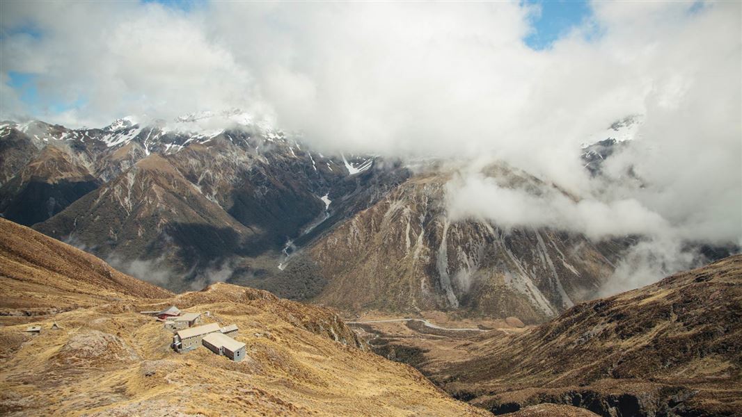
This track starts from above the bush line at the Temple Basin car park, 5 km north of Arthur’s Pass Village. It zigzags steeply up the hill to an open tussock basin, ski-club buildings, and the Lockwood day shelter.
The marked track finishes at the Lockwood Day shelter. There is no marked route above this point. There is complex avalanche terrain beyond the shelter.
From November to February, the alpine flowers present in the alpine meadows are typically in bloom.
On a clear day you get magnificent views of Mt Rolleston/Kaimatau across the valley.
This track starts above the bush-line from the SH73 roadside carpark for Temple Basin ski-field, 5 km towards the West Coast from Arthur’s Pass township.
Be safe and be aware – this is mountain country.
- Take warm clothing, a raincoat, sunhat, sunscreen, something to eat and drink and strong footwear (boots are recommended).
- Check the weather forecast before you go. Be aware that mountain weather can change quickly.
- Walking on tracks and routes above the bush-line (the upper edge of the forest) is recommended only in good weather conditions. This route is marked as far as the ski field. Above the bush-line you are exposed to the severity of the mountain weather.
- When snow covers the ground, routes will be less obvious and there may also be a danger of avalanches. Snow climbing equipment is recommended.
Temple Basin ski area avalanche control
Temple Basin ski area can be operating between late June and late October.
Avalanche control work on the ski area is done to make the ski area safe while they are open for skiing. Explosives may be in use for avalanche control work. There may be avalanche hazards outside of normal opening hours or in closed parts of the ski area. During those times you need to take the ATES classification and avalanche danger level into account.
Check in with ski patrol if you wish to access the area during operating hours and obey all ski area closures.
There may be avalanche danger
Avalanches usually occur from May to November in Arthur’s Pass National Park. There can also be avalanches outside this period, if there is still snow coverage.
Check the avalanche terrain in this area.
If you are going into avalanche terrain, always:
- Have the relevant avalanche skills and training.
- Check the ATES rating and New Zealand Avalanche Advisory before you go.
- Go with a buddy. Both of you should carry and know how to use an avalanche transceiver, a snow shovel and a probe.
Arthur's Pass National Park Visitor Centre
| Phone: | +64 3 318 9211 |
| Email: | arthurspassvc@doc.govt.nz |
| Address: | 104 West Coast Road Arthur's Pass 7654 |
| Hours: | Visitor centre hours and services |