5 km return via same track
The track starts from the gravelled car parking area off of SH73. You will need to cross a creek at the beginning of the track, if it has been raining heavily this may not be possible.
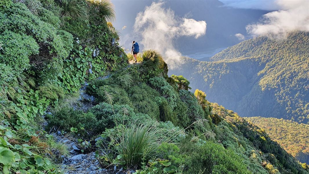
The track climbs steeply through rātā/kāmahi forest and subalpine scrub. This leads on to tussock grasslands surrounding Carroll Hut on Kelly Range. On fine days there are good views from the saddle behind the hut, looking down the Taramakau River to the West Coast.
Side trip to Kellys Hill
A side trip to Kellys Hill can give great views out to the Tasman Sea on a fine day. It is an unmarked route from Carroll Hut to Kellys Hill, recommended only for experienced alpine trampers.
This route should only be attempted in good weather conditions as you will need good visibility to find your way. Bring navigational equipment with you as conditions can change rapidly.
The track starts at Kellys Creek, 3 km north of Otira village on SH73.
Carroll Tops to Taipo Valley access washed out
Access to the Taipo Valley from the Carroll tops has been washed out in the lower sections of Seven Mile Stream, with the river cutting into the bank.
Travel now requires crossing Seven Mile Stream, which is uncrossable at high flows.
This track is for experienced trampers
It is steep and rugged. Stay on the track by following the orange markers. Share your plans with a trusted contact.
Be prepared for delays or an unexpected night out. Carry warm and waterproof clothes, an emergency shelter, spare food, a torch with extra batteries, a distress beacon, and a fully charged mobile phone.
Walking above the bushline
If you plan to go above the bushline, you need to seek advice from Arthur’s Pass Visitor Centre staff before going on your trip. There is no marked track above the bushline.
What to take
Take a compass and map, and know how to use them. Conditions can change rapidly and you may need these for navigation if visibility deteriorates.
Do not proceed above the bushline on to the open tops unless you have sturdy footwear, a waterproof parka and spare warm clothing including warm headwear and gloves.
Weather
Check the Arthur's Pass National Park weather forecast before you go. Walking above the bushline is recommended only in good weather conditions as you need good visibility to find your way. Above the bushline you are very exposed to the severity of the mountain weather.
If it is raining, stormy or there is low cloud around the mountains, there will probably be no views above the bushline. Conditions will be unpleasant at best and dangerous at worst.
Expect snow, ice and avalanche risk in winter
This track can be covered in snow in winter. When snow is present, you will need an ice axe, crampons, an avalanche transceiver, probe and shovel, plus avalanche assessment skills.
One or more avalanche paths cross this track. Avalanches are more likely to cross the track during and after heavy snow or rain when there is already a lot of snow on the high mountains. The avalanche paths on this track are not marked.
You can find a video series, Avalanche Tips and Terms: From the forecast to the field, on the NZ Avalanche Advisory website
Stay safe in the outdoors
- Choose the right trip for you. Learn about the route and make sure you have the skills for it.
- Understand the weather. Check weather forecasts.
- Pack warm clothes and extra food. Check gear lists.
- Share your plans and take ways to get help. Leave your intentions with a trusted contact and take a distress beacon.
- Take care of yourself and each other.
Arthur's Pass National Park Visitor Centre
| Phone: | +64 3 318 9211 |
| Email: | arthurspassvc@doc.govt.nz |
| Address: | 104 West Coast Road Arthur's Pass 7654 |
| Hours: | Visitor centre hours and services |