View maps and GPS boundary information for marine protected areas in Hauraki Gulf/Tīkapa Moana:
- overview map (PDF, 3,727K)
- overview GPS file (GPX, 18K) for general reference only, do not use for navigation
- maps and GPS boundary files (PDF, 1413K)
- information about high protection areas and seafloor protection areas
View a map and get the boundary GPS points of the Cape Rodney-Okakari Point Marine Reserve (Goat Island or Leigh).
View a map and get the boundary GPS points for Motu Manawa-Pollen Island Marine Reserve.
View a map and get the boundary GPS points for Tāwharanui Marine Reserve.
View a map and get the boundary GPS points for Te Matuku Marine Reserve.
View the map and boundaries of the Long Bay-Okura Marine Reserve
Map of the location and boundaries for Te Whanganui-o-Hei/Cathedral Cove Marine Reserve.
View a map and get the boundary GPS points of the Pakatoa and Tarahiki/Shag Island High Protection Area.
View a map and get the boundary GPS points of The Noises High Protection Area.
View a map and get the boundary GPS points of the Rangitoto and Motutapu High Protection Area.
View a map and get the boundary GPS points of the Kawau Bay High Protection Area and Seafloor Protection Area.
View a map and get the boundary GPS points of the Te Hauturu-o-Toi/Little Barrier Island High Protection Area and Cradock Channel Seafloor Protection Area.
View a map and get the boundary GPS points of the Tiritiri Matangi High Protection Area and Seafloor Protection Area.
View a map and get the boundary GPS points of the Mokohīnau Islands High Protection Area and Seafloor Protection Area.
View a map and get the boundary GPS points of the Aldermen Islands/Te Ruamahua High Protection Area.
View a map and get the boundary GPS points of the Slipper Island/Whakahau High Protection Area.
View a map and get the boundary GPS points of the Motukawao Islands High Protection Area.
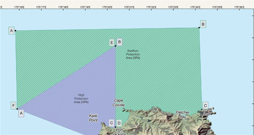
View a map and get the boundary GPS points of the Cape Colville High Protection Area and Seafloor Protection Area.