This research helps identify areas of high biodiversity, assess human impacts, and guide conservation and marine spatial planning. Accurate maps support decision-making for marine protected areas, fisheries management, and climate adaptation by revealing ecological patterns and gaps in protection. They also enable consistent monitoring over time and improve collaboration across agencies and regions.
Deep Reef Habitat Mapping
Deep reef ecosystems (below 30 m) are not well studied or protected, even though they host unique species and provide important ecological benefits. Relatively little research or management has been done, and we don’t even know where many of them are. This programme of work aims to develop a better understanding of deep reef ecosystems in Aotearoa New Zealand.
Review of deep rocky and biogenic reefs (50 – 300 metres water depth) knowledge in New Zealand: Biodiversity description, location, and threats
Published 2023
This report establishes a baseline for improving our understanding of deep reef ecosystems by reviewing and mapping potential proxies for reefs located between 50 to 300 m depth throughout the Territorial Sea and Exclusive Economic Zone.
Deep rocky and biogenic reef habitats of East Northland
Published 2023
Deep towed video footage (DTIS) and multibeam sonar data collected along the East Northland coast as part of the Bay of Islands OS2020 survey programme was used to describe and quantify the extensive deep reef (50–200 metres water depth) systems present on the continental shelf.
Deep rocky and biogenic reef habitats of East Northland (PDF, 7,612K)
A preliminary exploration of the rocky mesophotic communities of the Wellington Region
Published 2022
A survey of rocky deep-water features on the Wellington South Coast and Kapiti Coast to assess the benthic communities they support.
A preliminary exploration of the rocky mesophotic communities of the Wellington Region (PDF, 3,786K)
Hikurangi Marine Reserve DTIS video analysis
Published 2023
This report uses detailed seafloor images from surveys of the Hikurangi Marine Reserve and nearby areas to provide clear information about where different seafloor habitats, invertebrate communities, and fish are found.
Hikurangi Marine Reserve DTIS video analysis (PDF, 4,642K)
Marlborough Sounds offshore deep reef enhanced voyage report for four reef survey
Published 2025
This report describes a scientific survey of four deep offshore reefs in the Marlborough Sounds, revealing diverse marine life and habitats through underwater imagery and mapping.
Marlborough Sounds offshore deep reef enhanced voyage report for four reef survey (PDF, 8,341K)
Benthic community analysis to support the development of the Coastal and Marine Ecological Classification Standard (CMECS) for Deep Reefs (30-100 m) in the Hauraki Gulf
Published 2024
The primary aim of this project was to collect abundance data of the benthic communities from deep rocky reefs (30-100 m) in the Hauraki Gulf region using a remotely operated vehicle (ROV). This abundance data was then used in combination with information on geoform and substrate type to delineate biotopes using the Coastal and Marine Ecological Classification Standard (CMECS). The outputs include two reports describing methodology and analysis, and a catalogue of biotopes.
Collaborative regional mapping
DOC works in partnership with iwi, regional councils, government agencies, and research institutions to advance our understanding of marine ecosystems. Through collaborative seabed mapping and marine data collection, these projects combine expertise and resources to deliver high-quality information for conservation planning, biodiversity protection, and sustainable marine management.
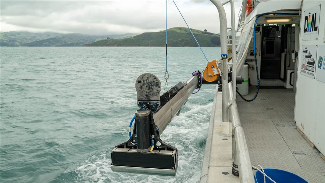
Iongairo (2023-2025)
Iongairo is a collaborative project mapping coastal marine ecosystems around Te Pātaka o Rākaihautū/Banks Peninsula to support marine planning and ecosystem management. Iongairo reflects the deep connection between land and sea in Te Ao Māori, strengthening knowledge for future stewardship.
Beneath the surface - seabed mapping around Te Pātaka o Rākaihautū / Banks Peninsula – Iongairo
Mapping Subtidal Habitats of Te Pātaka o Rākaihautū (Banks Peninsula) – Iongairo
Using Benthic Terrain Modeller to characterise Aotearoa New Zealand seafloor geomorphology
Published: 2023
Aotearoa New Zealand’s first national portfolio of benthic terrain models (BTM) from LINZ multibeam echosounder (MBES) data. Covering 52,000 km² from shallow coastal waters to deep offshore areas, these maps reveal seafloor features and habitats across 50 survey sites. The dataset spans 23% of the territorial sea and provides a consistent foundation for marine research, conservation planning, and ecosystem management.