Archived content: This media release was accurate on the date of publication.
Date: 23 January 2020
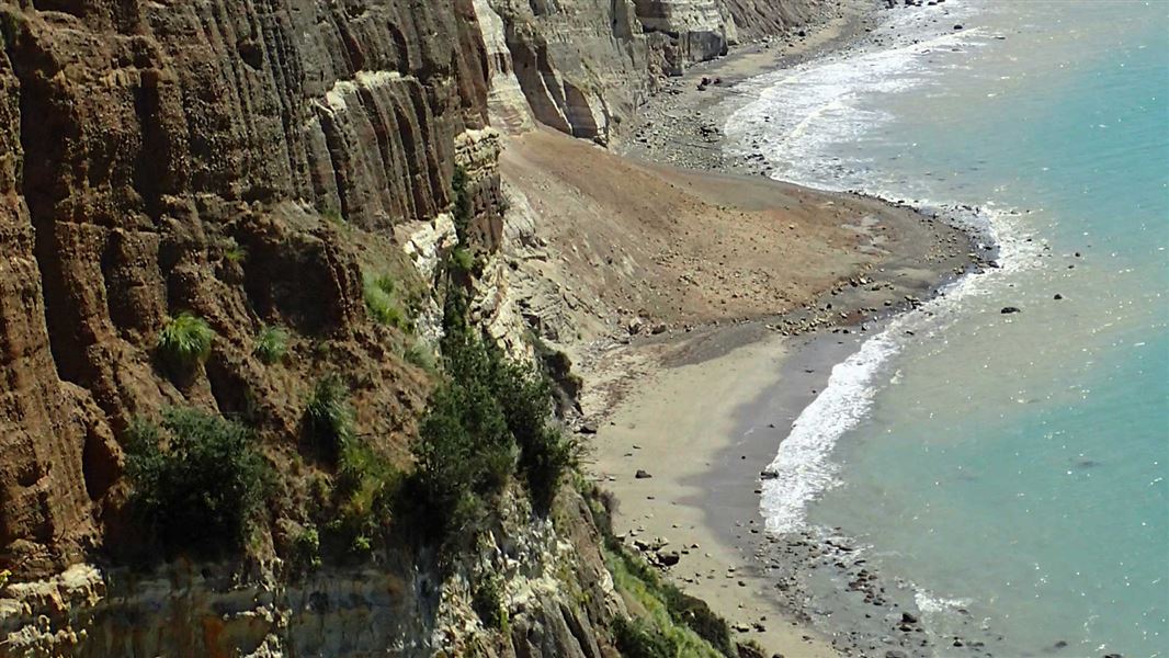
“Following the significant rock fall which seriously injured two tourists a year ago today, and ongoing rockfall events along this section of beach, we must fully understand the level of risk involved before encouraging people to undertake the whole journey (including 7 km each way under unstable cliffs) from Clifton to the main gannet colony,” says DOC’s Lower North Island Operations Director Reg Kemper.
In December, Gannet Beach Adventures resumed their tour along Clifton Beach, going to a smaller and closer gannet colony at Black Reef. Gannet Beach Adventures had previously ceased their operation after DOC closed its track providing access to the main gannet colony at Cape Kidnappers.
While the Quantitative Risk Assessment (QRA) is being finalised, DOC has suspended Gannet Beach Adventures’ concession to operate over conservation land at Black Reef, part of which is in close proximity to a significant fracture in the rock face above.
“DOC acknowledges Gannet Beach Adventures’ frustrations and concerns with the uncertainty around their business while we wait for the QRA to be finalised and peer reviewed,” says Reg Kemper.
“We are told this work is likely to take several months. When the QRA process began, the understanding was that it would be finalised by October last year at which time we could have made a decision that would give clarity to Gannet Beach Adventures about the future of their concession, prior to the peak visitor season.”
Hastings District Council commissioned and is managing the QRA report, which DOC has part-funded and fully supports. The report was delayed due to weather conditions and a need to recapture drone survey information. The QRA deals with technical analysis of the geology of the 8 km of cliffs and seeks to understand risks in a wider context.
“It’s a huge task and it’s important to get this right. DOC and the council are seeking to get as complete an analysis of the hazards and risk assessment as possible, and to meet best practice, which has meant accepting that the report will take longer to complete than first planned,” says Reg Kemper.
“While we acknowledge the work of Gannet Beach Adventures to mitigate risks, as well as their track record, the potential for multiple casualties, should a rockfall event occur, is significant.”
“In this situation where the risk involves the potential for multiple lives to be lost if another event occurs, it’s vital that we have all the information before reaching a decision on re-opening the DOC track or allowing concessions to recommence over DOC-managed reserves.”
Reg Kemper also asks for caution around relying on risk level information from the first draft of the QRA report.
“It’s really important we are clear on this for the safety of visitors. It’s not helpful to have misinformation going around, particularly when it might result in people making ill-informed decisions about the risk level they are prepared to take - for themselves, their families and people in their care.”
Background
Hastings District Council commissioned and is managing a Quantitative Risk Assessment to determine the level of risk to people travelling along the beach. Once the QRA is final (current timeline indicates this will not be before April 2020), DOC will be guided by its findings.
DOC will work with Hastings District Council and others, to determine the appropriate course of action regarding the DOC-managed section of Cape Kidnappers walking track, the walking track as a whole, and any concessions operating over DOC-managed areas along it. This work will be carried out as a priority.
Contact
For media enquiries contact:
Email: media@doc.govt.nz
