Public Conservation Land has been used for various historic activities that may have contaminated the soil. Contaminated sites may be found where there have been activities such as landfills, chemical and fuel storage, mining sites and livestock dipping, where chemicals were used, stored and disposed of in a way that was not safe by today's standards.
The contaminants associated with these activities and industries, may include landfill material, asbestos, pesticides, heavy metals/metalloids (such as arsenic, mercury, cadmium, copper and lead), and various hydrocarbon compounds. These contaminants are a problem when they occur at levels potentially may affect human health or the environment.
Contamination is not always limited to a specific site. Hazardous substances may seep through the soil into groundwater or be carried to nearby land and waterways in rainwater or as dust. The DOC work programme plans to mitigate impacts.
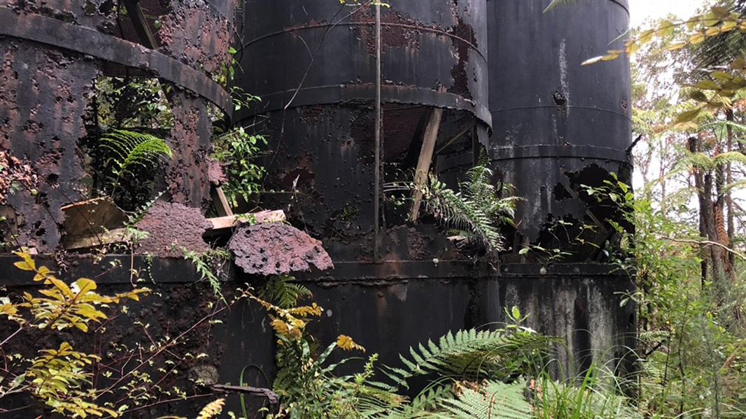
Image gallery
Some of these sites have not been in use for decades, and some have not been used more than a century, while others were more recently vacated by previous owners or occupiers.
In many cases, DOC has inherited these sites as they originate from activities that occurred prior to DOC’s establishment in 1987 but are now within land the department is responsible for. In other cases, DOC administers or manages small strips of land in coastal or natural environments adjacent to sites where heavy industry has occurred – but the operation has been shut down and the previous operator has left.
Managing contaminated sites
As a responsible land manager, with a duty of care to ensure the health and safety of people visiting the areas we manage, we have begun a long-term work programme to address the issues associated with contaminated sites.
DOC has undertaken preliminary risk screening and prioritised the known and potentially contaminated sites. Sites considered the highest priority have had, or have planned, investigations to determine the level of risk to environment and human health.
The new information understood about sites through investigations will be a key factor in our planning for further work. Once investigations are completed for a site there are several options available, including management of the site or remediation.
We will need to temporarily restrict public access to some contaminated sites to ensure the health and safety of visitors, and our staff and contractors. Any site closures are published on the site/track specific page on the DOC website. Treaty Partners and key stakeholders for any locations affected by closure would be informed directly and, in high use visitor locations, notification via local media outlets may also be provided.
At some sites the investigations may conclude contamination is not present at levels posing a risk to human or environmental health, and no remediation or long-term site management is required.
DOC’s Contaminated Sites programme has approximately $2 million per annum to deliver on its priorities. Some large or complex remediations may require additional funding to be obtained through external funding partners to enable delivery.
Contaminated Sites Programme priority list (PDF, 469K).
Significant works
Remediations completed
Awaroa/Godley Head
Location: 20 km from Christchurch city centre
Awaroa/Godley Head is a significant recreation and heritage site in Christchurch, receiving more than 100,000 visitors annually before its closure due to the discovery of asbestos in early April 2021. The site includes a campsite, historic World War II gun emplacements, and a network of walking and mountain biking tracks extending down to the ocean at Taylors Mistake. Asbestos and other contaminants were found in the roads at Awaroa/Godley Head in late March 2021 when testing was done ahead of a planned roading upgrades. This prompted wider testing which found asbestos in other areas of the complex, including the popular gun emplacements. This remediation component of the project included removal of contaminated soil to a secure encapsulated area away from public areas.
Awaroa/Godley Head reopens after remediation for contamination.
Ocean Beach Landfill
Location: 1 km from Bluff
Coastal erosion exposed a historic landfill contaminated with asbestos containing materials. The landfill is located across several parcels of land, and Environment Southland previously led the work for Detailed Site Investigations. DOC led the Remediation Options Assessment and Remedial Action Planning work, and the partial landfill removal (9,189 tonnes of landfill (317 truckloads)) and construction of a coastal protection wall to prevent any further coastal erosion in future of the remaining landfill was completed in mid-2025 (co-funded by DOC, MfE, and Invercargill City Council).
Work to protect Ocean Beach begins.
Little Tahiti Landfill
Location: 3 km from Milford Sound
A landfill within the Fiordland National Park the site is bordered by Tutoko and Cleddau rivers that was susceptible to fluvial erosion due to the area's high rainfall and extreme weather events such as those experienced by the region in 2020. DOC completed the Detailed Site Investigation and Remedial Options Assessment and the Remedial Action Plan. 6,836 tonnes (264 truckloads) of landfill waste was removed in mid-2025 (co-funded by DOC and MfE).
Vulnerable Milford landfill to be cleaned up.
Long-term Site Management Plans in place
This occurs when a site has undergone detailed investigations and can be safely managed under controls without significant remediation interventions.
Victoria Battery
Location: 10 km from Waihi
Home to the largest gold mining battery in New Zealand, the Victoria Battery Site was early to utilise cyanide in the gold extraction process, which later became commonplace across the world.
In partnership with stakeholders and iwi, the project sampled and confirmed the extent of contamination, risks to human and environmental health, and completed heritage and archaeological assessments. Sample results show largely contamination present on site does not pose a risk to human or environmental health. The Site Management Plan was developed to ensure effective future management and controls at some discrete areas of the site (where controls would be required if significant disturbance (ie earthworks) occurred for worker safety). Those discrete area will be proactively addressed in 2025.
Puhipuhi Mercury Mine
Location: 40 km from Whangārei
Puhipuhi Mercury Mine historic mine and deteriorated processing site, occupying part of the Waikiore Conservation Area, was identified as potentially contributing contamination into the surface water catchment. DOC worked with stakeholders and hapū on the investigation of the mine area and preliminary development of a remedial options assessment.
Sample results show contamination present on site does not pose a risk to human or environmental health. A Site Management Strategy and Plan was developed to manage the known contamination at the site.
Whakaari Scheelite Mines
Location: 3 km from Glenorchy
Gold miners discovered in 1884 the Glenorchy scheelite lode. The raw scheelite, a component of tungsten was extracted by hand, mechanical tools or hydraulic means. The Glenorchy Battery was set up to process the scheelite soon after mining began.
Site investigation results confirmed tungsten, arsenic and other elements are present at the historic mining site but at levels which do not pose risk to recreational users. The site remains open with controls in place (as per the Site Management Plan), including signage alerting the public not to drink water from the streams on site.
Work in progress
Hooker River Landfills
Location: 3 km from Aoraki/Mount Cook village
Project stage: Remediation planning
An historic landfill is being eroded by the Hooker River, Aoraki National Park. The river forms part of the headwaters of Lake Pukaki. Contaminated material at the landfill includes glass bottles, metal, ceramics, plastic, asphalt, ash/charred timber, fabric, and asbestos fragments. Rip-rap (boulder) erosion protection at the landfill and river stream training for the adjacent Tasman Bridge were completed in 2023 as part of interim mitigations, along with a clean-up of the Hooker Riverbed downstream of the landfill. A second landfill located further back from the Hooker River has also been investigated. Remediation options are being investigated, and stakeholders consulted, to determine the long-term plan for both landfills.
Snowy River Battery
Location: 40 km from Reefton
Project stage: Site investigations
The Snowy River stamper battery site operated between 1908 and 1938 using a variety of gold recovery methods. Naturally present arsenic became concentrated due to mining. Mercury and cyanide were used in the processes to obtain gold from crushed ore from the stamper batteries. Preliminary Site Investigation (PSI) results detected arsenic concentrations exceed the applicable Soil Guideline Values (SGV) for recreational exposure from samples collected at the main battery site area. The site has been closed to the public as per the Interim Site Management Plan recommendations. DOC is currently assessing options for remediation or management of the site long term.
Oamaru (Humber Street) Gasworks
Location: Oamaru township coast line
Project stage: Remediation planning
The Humber Street Gasworks operated as a gas production facility between 1876 and 1980. The historic buildings were demolished by landowner KiwiRail in 2019. However, the site’s contaminated area extends to DOC land on the coast. This site is also subject to coastal erosion, and investigation including test pits and water sampling wells to accurately detail the extent of contamination has been completed. The Remedial Options Assessment and Action Plan is to be completed in 2025, and DOC is working with KiwiRail and other stakeholders to determine future management and remediation options for the site.
Cobb Asbestos Mine
Location: 40 km from Tākaka
Project stage: Site investigations
The site is a known area of historical mining and processing of asbestos. In addition to the potential asbestos risk, elevated concentrations of nickel and chromium were also reported in the Preliminary Site Investigations. The Detailed Site Investigation (DSI) was completed in 2025 to delineate the extent of contamination and assess risks to human and environmental health. The DSI informs DOC and stakeholders of the extent of contamination at the site and its implications. The long-term site management options are being developed in 2025.
Pukapuka Inlet
Location: 50 km from Auckland city centre
Project stage: Remediation planning
The marginal strip extends over silt, clay and weathered rock materials associated with the underlying Mahurangi Limestone parent material. The site was used for an oyster farm operation in the 1980’s-90s. A Preliminary Asbestos Investigation report confirmed the presence of asbestos containing material (ACM) both on the surface of the Marginal Strip and within the fill/soil. ACM was also visible in the stream banks (Pukapuka Inlet). A Detailed Site Investigation, and Remedial Options Assessment and Plan, has been completed in 2025 to confirm remediation actions and long-term site management.
Lady’s Bay
Location: Kawau Island
Project stage: Site investigations
Located on the western side of Kawau Island, Lady’s Bay was used as a landfill for the demolishment of structures on the island in the 1970s. The landfill extends onto the beach and is now being actively eroded by the sea. The landfill is also possibly geotechnically unstable. DOC has undertaken a PSI and geotechnical investigation to determine a solution to address the current discharge of landfill waste and exposure of waste at the seaward wall of the landfill.
Waiuta Township
Location: 40 km from Reefton
Project stage: Site investigations
The historic Waiuta township was a mining settlement from 1906 until 1951, producing nearly 750,000 ounces of gold from 1.5 million tonnes of quartz. Mining activities and gold processing resulted in the concentration of naturally present arsenic. Mercury, cyanide and zinc were also used in the gold recovery process. This has resulted in contamination of soil and surface water (sampling for a site PSI confirmed elevated concentrations of contamination). A Detailed Site Investigation (DSI) was completed in 2024, and in 2025 the Remedial Options Assessment and Plan will be completed to direct the Long-Term Site Management Plan, and any necessary remediation activities.
Karangahake Gorge
Location: 10 km from Paeroa
Project stage: Site investigations
In August 2024 DOC received a report from Waikato Regional Council stating the Ohinemuri River had turned bright orange. The discharge was confirmed to be from the Comstock Mine in the Karangahake Gorge. There is a large mining legacy within the Karangahake Gorge catchment, including remote historic mine shafts and adits. A Preliminary Site Investigation (PSI) of all mining locations on PCL within the Karangahake Gorge, including desktop research, site visits, and soil and water sampling is the first step towards developing a management strategy. The PSI is due for completion in 2025.
Contact
For further information email: ContaminatedSites@doc.govt.nz, site-specific information available will vary from site to site, and may take time to compile.