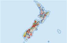
Maruia Valley hunting
Located in Greymouth hunting in the West Coast region
|
Introduction
The Maruia is a large area that extends from the Lewis Pass down to the Buller River. You can find red deer, chamois and goats here.Species
- Chamois
- Deer - Red
- Goats
Permit requirements
This hunting area is covered by an 'open area permit' – get it online or from a DOC office.
Dog access
About this hunting block
General information
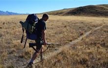
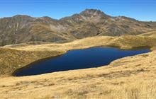
The Maruia is a large area that extends from the Lewis Pass down to the Buller River. There are several valley systems that provide access into the ranges on both sides of the valley and several walking tracks. The eastern Victoria Range, Freyberg Range and the Main Divide have accessible open tops.
Vegetation is mainly red and silver beech forest at lower altitude with tussock tops. The lower Maruia Valley is farmed.
Access
In many places in the upper parts of the valley access to conservation areas is possible directly off SH 7 and 65. Lower down permission to cross farmland is required.
Upper Maruia
Follow the St James Walkway from Lewis Pass to access Ada Pass.
A short track from the southern side of the Lewis Pass provides access to open tops on the Main Divide.
A track up Rough Creek leads to open tops on the Main Divide.
A walking track from Marble Hill goes to Pell Stream and Lake Daniell and a route continues through to the top end of Station Creek.
Mid Maruia
A 4WD road with fords provides access into Station Creek and Coal Creek.
The West Bank Road provides access to the eastern Victoria Range.
The Rappahannock Road provides access into Cave Stream with foot access to the Rappahannock Saddle and Glenroy Valley.
Access to the Maruia Gorge is from Boundary or Creighton Road. Private land needs to be crossed so please ask permission from Peter Brooker or David Sanders.
Lower Maruia
At Shenandoah the Lower Maruia Bridge provides access to forests on the western side of the valley and Glengarry Stream. Permission is required to cross freehold land. There is a locked gate.
Landholders
- Station Creek: Ricky and Kane Inch – Inca Farms Ph: +64 3 523 8993 or +64 3 523 8816
- Maruia Gorge: Peter Brooker Ph: +64 3 523 8884
- David Sanders Ph: +64 3 523 8956
- Glengarry: Pointons Ph: +64 3 523 9491,
- Deepdale: Mike Peacock Ph: +64 3 523 9416
Note: Thompson Flat at the head of Station Creek is freehold land.
Maps
NZTopo50 BR22, BR23, BS22, BS23, BT22, BT23.
Dogs
Dogs are prohibited in National and Scenic Reserves. All other areas are prohibited to dogs except where authorisation has been granted by DOC. People wishing to take a dog into this area should seek authorisation from the DOC office.
Huts
- Kōhanga Atawhai – Manson Nicholls Hut (at Lake Daniell). 24 bunk serviced.
- Cannibal Gorge Hut. Serviced 20 bunk.
- Ada Pass Hut. Serviced 1 bunk.
- Pell Stream Hut. Basic 4 bunks. No official track, not maintained.
- Wheel Creek Hut. 6 bunk.
Hunting
- Red deer can be found throughout the area at any time of the year and hunting during the spring and roar is popular.
- Chamois can be found in most alpine areas.
- Goats are common around Mt Rutland and occasional in Rappahannock to Caves Stream but are uncommon or absent elsewhere.
- Possums are regularly controlled by TBfree and DOC in the upper Maruia and Station Creek area.
Additional information
There is good trout fishing in the Maruia River.
Contacts
| Māwhera / Greymouth Office | |
| Phone: | 0800 275 362 |
| Fax: | +64 4 471 1117 |
| Email: | greymouth@doc.govt.nz |
| Address: |
17 High Street Greymouth 7805 |
| Postal Address: |
PO Box 370 Greymouth 7840 |
| Full office details | |