Black Hill Range/Mount Hutt hunting
Located in Mid & South Canterbury hunting in the Canterbury region
|
Introduction
Red deer, chamois and tahr are present in low numbers. The hunting season is open all year but with prohibited areas.Species
- Chamois
- Deer - Red
- Tahr
Permit requirements
This hunting area is covered by an 'open area permit' – get it online or from a DOC office.
Dog access
About this hunting block
General information
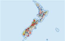
Black Hill Range/Mt Hutt is west of the Rakaia River and about 45 km northwest of Ashburton.
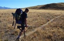
The area is steep and mountainous with Mt Hutt being the highest point at 2185 m. Most of the area is tussock and alpine herbfields but there is mountain beech forest in the Pudding Hill Stream catchment.
Note, hunting is not permitted in:
- Awa Awa Rata Reserve (administered by the Ashburton District Council)
- Pudding Hill Scenic Reserve
- Mt Hutt ski field area
- Redcliffe Stream area
Access
Arundel Rakaia Gorge Road SH77 gives access to McLennans Bush Road, which leads onto the Mt Hutt ski field access road. During summer, there is a locked gate near the overflow skifield car park. Pudding Hill Stream - Hart Road can also be accessed off the Arundel Rakaia Gorge Road.
From Arundel Rakaia Gorge Road SH77 at Mount Hutt follow Blackford Road and then Double Hill Run Road. Signs mark the public easements across private land to the hunting block keep to the marked track.
Helicopter landings may be approved in certain areas provided an appropriate landing permit is obtained.
Topo maps
NZTopo50 map sheets: BW20 Lake Coleridge, BX20 Methven
Huts
There are no huts or bivvies in this area.
Contacts
| Raukapuka / Geraldine Office | |
| Phone: | 0800 275 362 |
| Email: | info@doc.govt.nz |
| Address: |
13 – 15 North Terrace Geraldine 7930 |
| Postal Address: |
PO Box 33 Geraldine 7956 |
| Full office details | |