Mid Hunter hunting
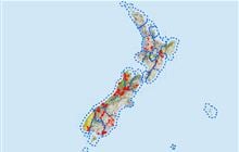
Located in Hāwea Conservation Park hunting in the Otago region
|
Introduction
Animals present are red deer and chamois in the Mid Hunter hunting block, which consists of the catchments feeding the Hunter River for some 15 km above its mouth.Species
- Chamois
- Deer - Red
Permit requirements
This hunting area is covered by an 'open area permit' – get it online or from a DOC office.
Dog access
About this hunting block
Animals present are red deer and chamois in low to moderate numbers.
General information
This block consists of the catchments feeding the Hunter River for some 15km above its mouth. The main tributaries on the true right, Waterfall, Cascade, Lake and Scrubby Flat Creeks, are all badly gorged in their lower reaches – for this reason access is mainly by air. On the true left the block includes the less valleyed slopes that rise to the Huxley Range.
Vegetation is mainly tussock grassland rising to alpine gravel and rock on the true left. The valleys on the true right contain extensive beech/tawhai forest and subalpine shrubland.
There is a marked route up Long Flat Creek near Ferguson Hut; note that the bridge shown on older versions of NZ topo50 BZ13, at E1323311 N5108743 has been removed.
During the roar period in the months of March and April, the block divides into four separately balloted portions:
- Cotters Creek (true right of Hunter, also includes Green Gully, Lake and Cotters Creek catchments)
- Cascade Creek (true right of Hunter, also includes upper Waterfall Creek catchment)
- Bull Flat (the true left and right of the Hunter Valley including: Scrubby, Long Flat and Billy Creek catchments)
- Green Bush (includes: Wind Pudding Creek and Green Bush Gully)
Huts
There are no DOC huts in these blocks, all huts in the area belong to either Hunter Valley or Dingle Burn Stations, and you must obtain permission to use them.
Access
For all catchments on the true right including Bull Flat, helicopter access is required due to badly gorged lower reaches. Fixed wing access to Wind Pudding airstrip is also possible.
Unless an authorised aircraft operator is being used, for helicopter of fixed wing access you must obtain an aircraft landing permit from the Tititea/Mt Aspiring National Park Visitor Centre in Wanaka.
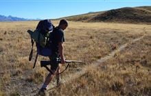
Foot access to this block is available on the Lake Hawea eastern side: from Hawea Township take Gladstone Road and then Dingle Burn Station Road for 14 km to a car park. From here follow the track (you may carry unloaded firearms) to Turihuka Conservation Area and beyond to the Hunter River mouth where the hunting block starts – 8–10 hours from the car park.
For the Western side, Meads road gives access to the Kidds Bush Camping Area. Access along the western side of Lake Hawea to the Hawea conservation park beyond Terrace Creek requires prior permission from Hunter Valley Station Managers.
The station manager recommends and in the case of high river levels, may insist on a raised 4WD with snorkel for vehicle access beyond Hunter Valley Station Homestead due to multiple creek and river crossings.
Feedback on your access experience is welcome. Email this to: wanakavc@doc.govt.nz
Landholders
Western side: Hunter Valley Station: phone +64 3 443 1242
Eastern side: Dingle Burn Station.
Maps
NZTopo50 series: BZ13, BZ14
- Cotters Creek hunting block map (PDF, 1,576K)
- Cascade Creek hunting block map (PDF, 1,627K)
- Bull Flat hunting block map (PDF, 1,726K)
- Green Bush hunting block map (PDF, 1,693K)
Know before you go
Dogs
Dogs are allowed only if using air access. No separate permit required.
Help control wallabies in this area by reporting sightings
Wallabies can displace other species, affect pastures and native species' habitats.
They also potentially impact production and native ecosystems.
Report your sighting online – it only takes a few minutes.
You can also report wallaby sightings by calling 0800 80 99 66.
Contacts
| Tititea / Mount Aspiring National Park Visitor Centre | |
| Phone: | 03 4437660 |
| Email: | wanakavc@doc.govt.nz |
| Address: |
1 Ballantyne Road Wanaka 9305 |
| Postal Address: |
PO Box 93 Wanaka 9343 |
| Full office details | |