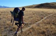
Braeburn Range hunting
Located in Nelson Lakes hunting in the Nelson/Tasman region
|
Introduction
Moderate red deer numbers exist throughout the Braeburn Range area. Pigs are also present with the occasional chamois and goat.Species
- Chamois
- Deer - Red
- Goats
- Pigs
Permit requirements
This hunting area is covered by an 'open area permit' – get it online or from a DOC office.
Dog access
About this hunting block
General information
The Braeburn Range site is an area of conservation land and scenic reserve running from the Buller River near the Owen River confluence on SH6, over Mt Murchison, across the Braeburn road, and along the Braeburn Range to the Ella Range at the most northerly point. The site has an eastern boundary often abutting that of the Nelson Lakes National Park, and includes the significant valley of the Tiraumea.
Moderate red deer numbers exist throughout the area and the occasional fallow may also be encountered where they have been released or escaped.
Pigs are also present but tend to be in higher numbers on the fringes with farmed land.
The occasional chamois and goat may also be encountered. Hunters are urged to shoot any goats they see and report numbers shot and approximate location to the local DOC office.
Access
Access to the hunting on Mt Murchison and the Gowan end of the Braeburn Range is very limited, as it is mostly surrounded by private land. However access can be gained off the Braeburn road, through the Tiraumea Valley and through land opposite the Mataki Lodge on the Tutaki South Road.
See the Matakitaki Valley special conditions for dog access through Mt Ella Station (below).
Landholders
Any access through private land to the area requires the landowner’s permission.
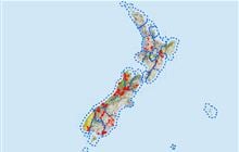
Map
NZTopo50 BR23
Dogs
Hunting dogs are allowed by permit only and are allowed to be overnight in the area.
Dog permits are available from the local DOC office.
Matakitaki Valley
- Access with dogs through Mt Ella Station from the car park to access the Watson Creek area requires specific permission from the landowner, Phone3+64 3 523 9414.
- Dogs are not permitted on the valley floor south of Mt Ella Station or in the Nelson Lakes National Park.
Huts
About Teetotal sighting-in range
Teetotal sighting-in range is located off Teetotal Road in the Teetotal Recreation Area approximately 3.3km northwest of St. Arnaud.
Hunters can safely check their rifle sightings at the Teetotal sighting-in range facility before heading into nearby parks and conservation land to hunt.
To use the sighting-in range you must have a Teetotal sighting-in range permit, or be under the supervision of a Range Officer. This is a legal requirement under the Arms Act 1983 from 1 July 2023.
Contacts
| Rotoiti / Nelson Lakes Visitor Centre | |
| Phone: | +64 3 521 1806 |
| Email: | nelsonlakesvc@doc.govt.nz |
| Address: |
View Road St Arnaud |
| Postal Address: |
PO Box 55 St Arnaud 7053 |
| Full office details | |