This track is part of the West Coast Wilderness Trail (Ngā Haerenga New Zealand Cycle Trails).
9.9 km one way
Video
Brochures
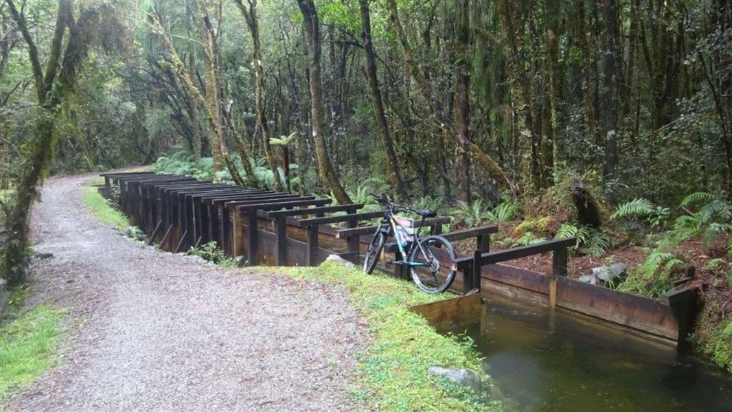
The walkway follows a historic power station water race as it twists and turns along the edge of a scenic reserve.
The walkway starts at the Landing at the northern edge of Lake Kaniere and ends at Kennedy Creek on the Hokitika-Lake Kaniere Road.
The walkway contains two distinct sections:
Lake Kaniere to Wards Road
This track section is walking track and a Grade 2 mountain bike ride. It is part of the West Coast Wilderness Trail (which then follows Wards Road rather than continuing the along the water race).
Expect a wide (around 1.5 m) track with a good surface. It is mostly flat with a few gentle inclines. All stream crossings are bridged.
The track follows a working water race and there are drop offs in places, so keep an eye on children.
Wards Road to Kennedys Creek Road
This track section is a more challenging tramping and biking experience. It is a Grade 4: Advanced to Grade 5: Expert mountain bike ride and is not part of the Wilderness Trail.
You can expect:
- a narrow (less than 0.8m) track
- a rough and uneven track surface, with tree roots and rocks
- steep drops beside the track s
- steps that you will have to carry your bike up and down.
From Hokitika head east 19 km along Lake Kaniere Road, this road meets the lake at 'The Landing'. The road forks at this point, the right road heads to 'Sunny Bight' and the other is Dorothy Falls Road which takes you around the east side of the lake past Hans Bay.
This is a shared-use track. Follow the mountain bikers code: respect others, respect the rules, respect the track.
Wards Road to Kennedys Creek Road section
You will need a full suspension mountain bike, puncture kit and first aid kit.
If you don’t have the experience for a Grade 4/5 ride, we recommend choosing the Lake Kaniere to Wards Road section of the track instead.
Paparoa National Park Visitor Centre
| Phone: | +64 3 731 1895 |
| Email: | paparoavc@doc.govt.nz |
| Address: | 4294 Coast Road Punakaiki RD 1 Runanga 7873 |
| Hours: | Visitor centre hours and services |