900 m - 2 km
Nelson Creek has a number of short walks to choose from, including the wheelchair accessible Colls Dam Walk.
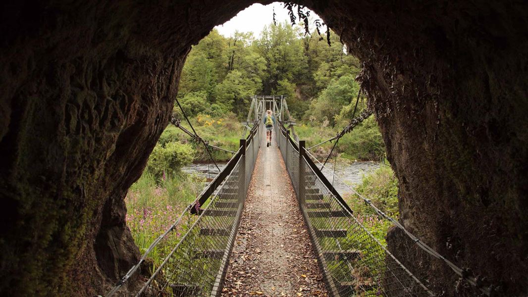
To find the starting point for the walks, walk through an old hand picked tunnel and cross the Nelson Creek suspension bridge.
Callaghans Track
Time to the lookout: 30 min, one way
Distance: 1.3 km, one way
Time to Prices Creek Road: 45 min, one way
Distance: 2 km, one way
This easy to moderate track climbs steadily to a mossy knoll lookout point where you get a view into the bush clad valleys on either side of the ridge. On the way to the lookout point the track crosses a couple of deep tail races and a large water race as well as passing through regenerating beech.
As the track climbs the forest is mostly podocarp/hardwood with rimu, miro, rata, quintinia and kamahi being the most common species. After the lookout point, the track levels out and eventually links with Prices Creek Road- a forestry road. Return by the same route.
Tailrace Walk
Time: 20 min return
Distance: 900 m
This short walk crosses a number of impressive tailraces. Old gold workings are also visible throughout the red and silver beech which are the dominant tree species.
Colls Dam Walk
This walk has wheelchair access
Time: 40 min loop track
Distance: 1.1 km
This high quality walk must be started from Gows Creek carpark if you wish to get wheelchair access.
The walk takes in some good examples of tailraces and tailings as well as providing a pleasant lookout point above the historic Colls Dam.
From Greymouth follow SH7 about 25 km north to Ngahere. Turn right at the Ngahere-Kopara Road and carry on to the Nelson Creek Settlement. The turn off to access the picnic, camping area and walks is opposite Nelson Creek Hotel.
- You should wear comfortable footwear and take wet weather clothes as the West Coast is known for sudden changes in weather.
- Wasps will be present through out this area in summer.
- Take care off formed tracks as shafts and tunnels are scattered throughout the area.
- Follow gold fossicking rules.
The forest in the Nelson Creek area, which is predominantly beech, is now regenerating. It was felled in the past to provide fuel and timber for huts, fluming and other mining structures, and was used in farming to a small degree.
Red and silver beech can be seen on the lower slopes and hard beech on the higher slopes.
Tailings
The Nelson Creek area is formed from layers of sandstone overlaid by glacial outwash gravels. Gold was concentrated in trough-like hollows on the surface of the sandstone.
Ground sluicing was the main method of working the gold. Sluicing needed a good supply of water which was directed over the working face, washing the gravels out.
Large rocks were lifted aside and stacked as tailings, while the smaller material was washed down tailraces containing riffle boxes to 'save' the gold. Tailraces were also essential to remove excess water from the working area.
Nelson Creek has had a varied goldmining history of success and decline from its beginnings in 1865, when it was rushed as a shallow creek working, which yielded shotty course gold. Some areas were rich in gold but finds were patchy.
At the height of the rush over 1200 miners were scattered throughout Try Again Terrace downstream from Nelson Creek, but numbers fell almost immediately, once the productive ground was worked out.
Nelson Creek suspension bridge
The suspension bridge crossing Nelson Creek is a historic bridge. It was originally built in 1872 and has been rebuilt a couple of times, most recently by the New Zealand Forest Service in 1982 using the original plans.
Paparoa National Park Visitor Centre
| Phone: | +64 3 731 1895 |
| Email: | paparoavc@doc.govt.nz |
| Address: | 4294 Coast Road Punakaiki RD 1 Runanga 7873 |
| Hours: | Visitor centre hours and services |
