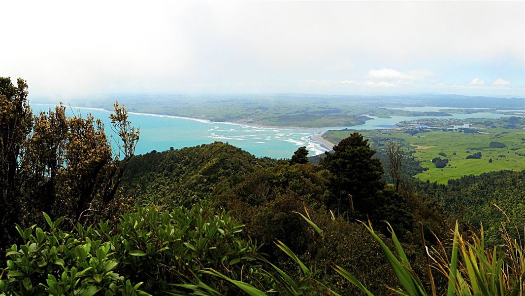
Located in Karioi area and Pirongia Forest Park in the Waikato region
On a fine day you can see as far south as Mt Taranaki, the Herangi Range and Pureora. There is also a good view of all the local harbours as well as Pirongia, Maungatautari and Te Aroha mountains.
There are two tracks up to the summit of Karioi. Do a return trip on one track, combine the tracks and cross the mountain (you'll need to arrange transport).
Mt Karioi
Time to lookout: 2 hr 30 min - 3 hr one way
Time to summit: 3 hr - 3 hr 30 min one way
This is the steeper but more scenic of the two summit tracks.
Once over the stile at the start of the track, it’s all up hill, but there are plenty of good vantage points to stop, catch your breath and admire the view. After passing through a grove of kānuka, the track climbs up a grassy slope before reaching the main ridge. Chains and ladders have been installed to help negotiate the occasional rocky outcrop. At a large rocky bluff the track sidles around to the north for a short distance then climbs steadily to the ridge. At this point, a short 10-minute side track takes you to a lookout providing good views across Raglan Harbour.
Back on the main track it is another hour to the summit (756 m) along an undulating ridge. The vegetation along the ridge has been sculptured by the strong prevailing westerly wind. The forest changes from kohekohe at lower altitudes to tawa forest, to kamahi and tāwheowheo towards the top. Other species of note include miro, toro, horopito and Dracophyllum traversii.
Getting there: Start this track at Te Toto Gorge, 13 km from Raglan. Note, the last 4 km of Whaanga Road are unsealed.
Time: 2 - 3 hr one way
This is the shortest route to the summit and isn't as steep as sections of the Karioi Track. It doesn't have the same views.
It’s a 40-min walk across private farmland to the bush edge. Respect the access privilege which is only available during daylight hours.
From the bush edge, the track climbs steadily through coastal forest, comprising kohekohe, māhoe, rewarewa, kamahi and a variety of ferns and shrubs, to the summit.
Getting there: The track starts at the end of Karioi Road, off Ruapuke Road.
The high level tracks on Karioi follow steep-sided ridges. Water is difficult to find, especially in summer, so be sure to take sufficient drinking water with you.
Before you go into the outdoors, tell someone your plans and leave a date and time to raise the alarm if you haven't returned. To do this, use the New Zealand Outdoors Intentions process on the AdventureSmart website. It is endorsed by New Zealand's search and rescue agencies and provides three simple options to tell someone you trust the details about your trip.
Te Rapa Office | |
Phone: | +64 7 850 8378 |
Fax: | +64 4 471 1117 |
Email: | waikato@doc.govt.nz |
Address: |
5 Northway St Te Rapa Hamilton 3200 |
Postal Address: |
PO Box 20025 Te Rapa Hamilton 3241 |
Full office details |