Proposed amendments to Te Pēwhairangi (Bay of Islands) Marine Mammal Sanctuary
Submissions closed 30 March 2026.
For more information: Te Pēwhairangi (Bay of Islands) Marine Mammal Sanctuary management measures.
On this page:
Interactive map
This interactive map only shows the sanctuary's boundaries, not the safe zones. View the safe zone boundaries.
Coordinates and downloadable maps
Overview map
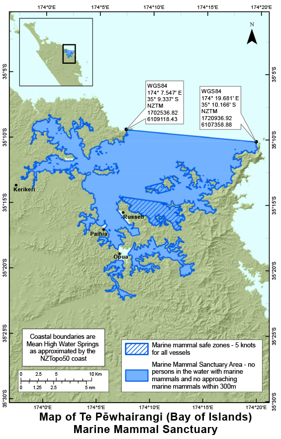
Download high-resolution version of the overview map (PDF, 3,243K)
Boundary close up maps
- Cape Brett boundary area (PDF, 430K)
- Doves Bay and Opito Bay boundary area (PDF, 484K)
- Kororareka Point to Tahapuke Bay boundary area (PDF, 366K)
- Matauwhi Bay boundary area (PDF, 357K)
- North-west corner of Te Pēwhairangi (Bay of Islands) Sanctuary (PDF, 429K)
- Opua boundary area (PDF, 402K)
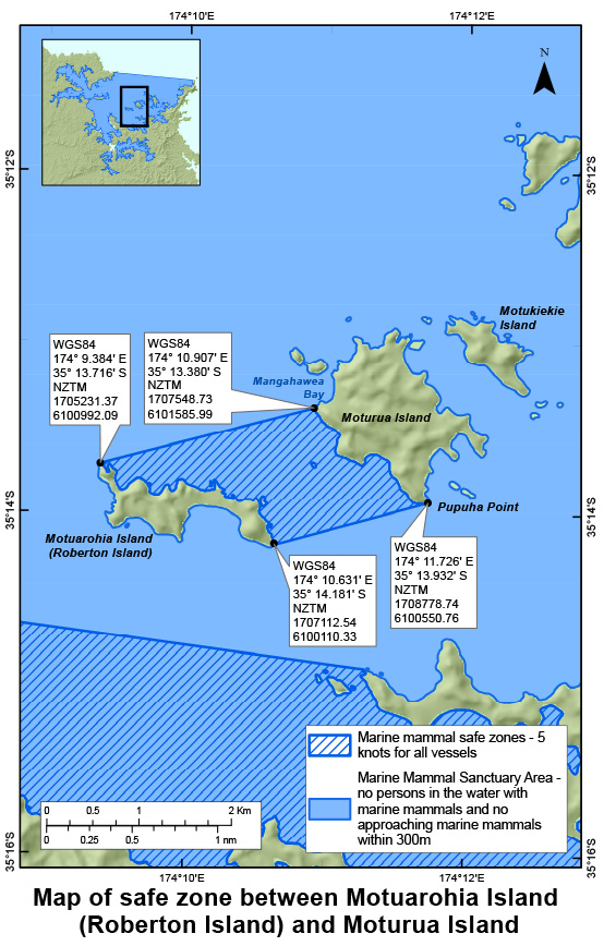
Maps of the safe zones
There are two marine mammal safe zones in the Te Pēwhairangi (Bay of Islands) Marine Mammal Sanctuary.
Restrictions for vessels in marine mammal safe zones.
Safe zone between Motuarohia Island (Roberton Island) and Moturua Island
Safe zone from Tapeka Point to Whangaiwahine Point
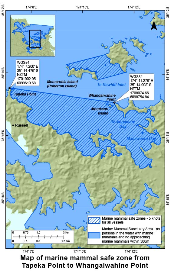
Download high-resolution map of safe zone between Tapeka Point to Whangaiwahine Point (PDF, 2,115K)