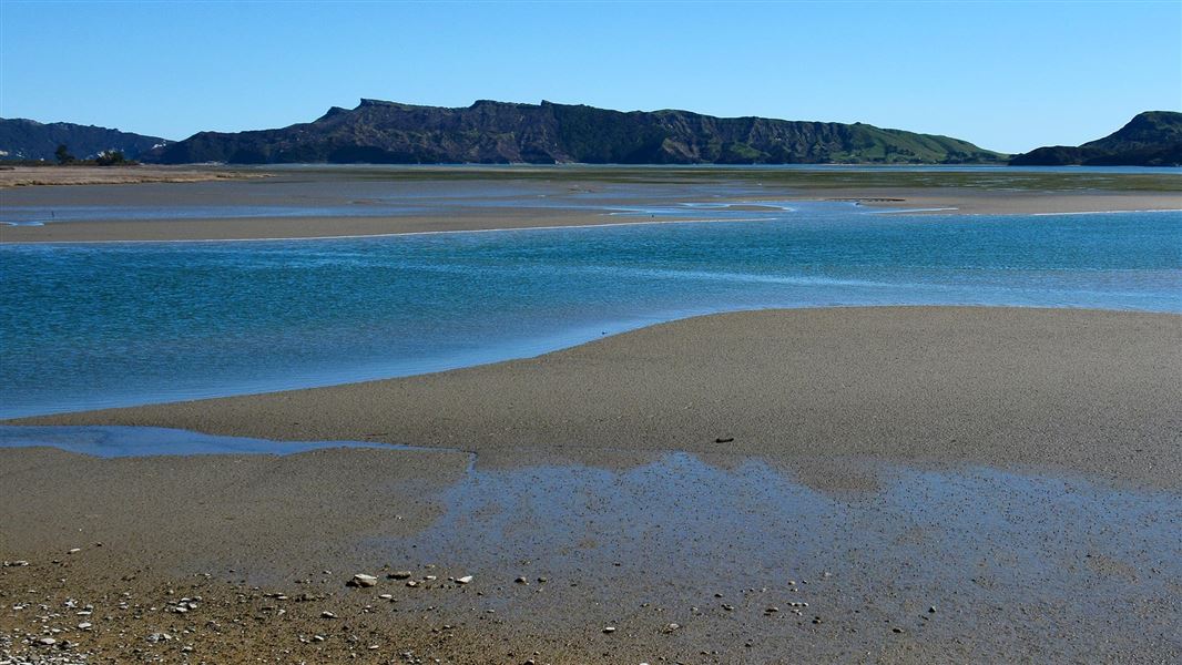
The marine reserve was established in 1994 and is 4,557 hectares.
Westhaven (Te Tai Tapu) Marine Reserve
Westhaven (Te Tai Tapu) Marine Reserve covers 536 hectares of tidal sandflats and channels within Whanganui Inlet, on the western coast of Golden Bay.
Westhaven (Whanganui Inlet) Wildlife Management Reserve
Westhaven (Whanganui Inlet) Wildlife Management Reserve stretches over 2112 hectares. It covers all tidal sandflats and channels not included in the marine reserve inside a line from Bar Point to South Head Cone.
The sea entrance to Westhaven (Te Tai Tapu) Marine Reserve is located 19 kilometres Southwest of Farewell Spit on the west coast of the South Island.
To get to there, follow the road from Collingwood to Farewell Spit, taking the left-hand fork just north of Pākawau.
The wildlife management reserve is about six kilometres on, just beyond the turn-off to Kaihoka Lakes. Continue on along Dry Road which leads around the inlet to Mangarākau, following the estuary shoreline most of the way.
The marine reserve protects all plant and animal life within its boundaries, benefitting not only fish and shellfish, but birdlife as well. Fishing and shooting are not permitted in the marine reserve.
Fishing in the Banjo and Wairoa River are not permitted. These are the estuaries on the creek side of the road and are part of the marine reserves.
Care in the water
Only experienced boaters should attempt launching from Mangarākau Wharf. Be aware that crossing the Westhaven sand bar is dangerous. Seek local knowledge if new to the area.
Estuaries are unique aquatic ecosystem. Salty ocean water mixes with freshwater rivers that many plants and animals thrive in. As the tide enters the inlet, it divides into northeast and southwest channels before spilling out onto expansive intertidal sandflats, which dominate the estuary.
Seagrass beds, salt marshes, tidal wetlands, dunes, cliffs, islands, rock platforms and underwater reefs are all found within the marine reserve and are important habitat to a variety of species.
Atleast 30 species of marine fish are known to use the inlet at some stage of their life cycle. The calm waters provide a safe breeding and nursery area for snapper, flatfish, and kahawai. Many fish enter the estuary for the rich food supply in the seagrass beds and sandflats.
Report illegal or suspicious activity
Don't take, disturb, kill or damage anything within the reserve - it's illegal. If you see people taking anything from the reserve, report the activity as soon as possible.
You can call 0800 4 POACHER (0800 476 224) or 0800 DOCHOT (0800 362 468).
It is also an offence to pollute or litter the reserve, discharge any firearm in or into the reserve or erect any structure in the reserve.
Reporting pests
Find-A-Pest lets you report potential pest species, including marine, plant, animal and fungal species.
If you come across something out of the ordinary, upload a picture to the app and a specialist will help identify it. If it's a biosecurity threat, this will be forwarded to Biosecurity New Zealand. If possible, take photos and record the location and name of the vessel.
Or call the Ministry for Primary Industries' Pest and Diseases hotline on 0800 80 99 66.
Top of the South Marine Biosecurity Partnership
We work closely with partners through the Top of the South Marine Biosecurity Partnership to manage the threat of marine pests.
Tikanga Maori
The Westhaven Inlet area has always been important to Maori, both as a food basket and as a place to live. Sacred sites and evidence of previous occupation remain today.
Ki a koutou katoa
The manawhenua iwi are Ngati Rarua, Ngati Tama and Te Atiawa.
Deforestation
When Europena settlers arrived, the coastal forest around the inlet was selectively logged, the flax milled and the land mined for coal and gold. A road was built to service the farms and the milling activities on that coast which is how visitors now access the reserve.
Protect our marine reserves
- No fishing of any kind.
- Don't take or kill marine life.
- Don't remove or disturb any marine life or materials.
- Don't feed fish - it disturbs their natural behaviour.
- Take care when anchoring to avoid damaging the sea floor.
Whakatū/Nelson Visitor Centre
| Phone: | +64 3 546 9339 |
| Email: | nelsonvc@doc.govt.nz |
| Address: | Millers Acre/Taha o te Awa 1/37 Halifax Street Nelson 7010 |
| Hours: | Visitor centre hours and services |
