Teetotal Trails
Village Link Track
Distance 1.76 km (one way)
Grade: Easy
Village Link track leads through regenerating bush and kānuka forest west from the Beechnest Crest in the village to the Skating Pond Loop and the Teetotal tracks.
Teetotal Road
Distance: 5.9 km (one way)
Grade: Easy
Turn off State Highway 63 at the Teetotal Recreation Area and ride on unsealed road along Teetotal Flats. You can access the Teetotal mountain bike trails from this road.
Skating Pond Loop
Distance: 4.7 km (circuit)
Grade: Easy
From the skating pond follow the duck pond stream for 500 m before climbing up to Teetotal Flats. The track then meanders through open grassland and matagouri and kānuka scrub. On arriving at the Teetotal Road the track continues about 100 m to the left on the opposite side of the road before then returning to the pond.
Big Bush Track
Distance: 1,3 km (one way)
Grade: Intermediate
The track begins at the top of Jasmine Rd and climbs to the top of the Big Bush ridge. Follow east along the ridge to access the top of Flying Moa and Kaka. This is the easiest route to the top of Big Bush.
Sidewinder Track
Distance: 3.2 km (one way)
Grade: Advanced
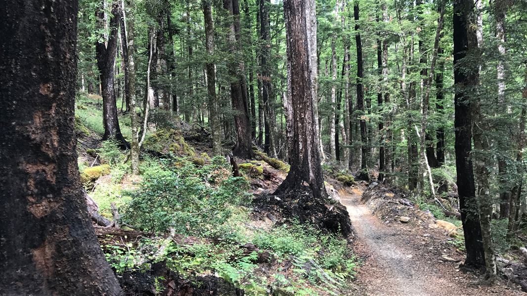
Starting at the furthest extent of the Skating Pond Loop, the track soon enters mature beech forest. This technical track travels over largely unmodified beech forest floor, with slippery sections, exposed roots and stream crossings. After 1 km the track opens out into grassy flats before returning to beech forest. After 2.5 km the track descends down to Teetotal Flats and meanders to meet Teetotal Road.
Kaka Track
Distance: 2.7 km (one way)
Grade: Intermediate
Duck Down Track
Distance: 2.5 km (one way)
Grade: Advanced
Rocky Horror Track
Distance: 1.5 km (one way)
Grade: Expert
Linked to Skating Pond Loop at two points, the Kaka Track travels through the mature beech forest of the Big Bush conservation area, climbing steadily to the ridgeline. From here you can turn left and follow the Big Bush Track for 3 km before descending steeply to the forestry roads and eventually Teetotal Road.
Alternatively, you can turn right and follow the ridgeline until you get to a junction – from here you can either descend via the technically advanced Duck Down Track or expert riders can use the Rocky Horror Track.
Rattler Rim
Distance: 4.2 km (one way)
Grade: Easy
The track roughly follows the top of the escarpment above the Buller River flats and is mostly level. It twists and turns through open clearings and manuka scrub and allows riders to access the west end of Big Bush and Douglas Hill without riding on Teetotal Road.
Flying Moa
Distance: 2.6 km (one way)
Grade: Intermediate
The track starts 485 m west of the top of Kaka Track off the Big Bush track. It descends 260 m through mature beech forest, twisting and turning amongst the trees to provide a challenging intermediate ride. It is not designed to be a fast flowing track, it is rather a technical track to test the skills of the intermediate rider. At the bottom it connects with the west end of Sidewinder Track. You can make a loop by riding back along Rattler Rim Track.
The turn-off for the Teetotal Recreation Area mountain bike trails is about 1.5 km west of St Arnaud on State Highway 63. Follow the short road to the start of the trails, which range from easy to expert. Leave gates as you find them.
Shared tracks
These are shared-use tracks. Follow the mountain bikers code: respect others, respect the rules, respect the track.
The Teetotal mountain bike tracks cross both public conservation land and OneFortyOne leasehold land, which are all multi-use.
All visitors must be aware that other people, including hunters, could be in the area. Report any damage to trails or signs to the Rotoiti/Nelson Lakes Visitor Centre.
Public access for mountain biking or walking over the forest land has been granted by OneFortyOne. All persons entering the forestry area do so at their own risk. OneFortyOne takes no responsibility for any damage or loss they may suffer in doing so. All riders and walkers must stay on formed trails and riders must not exceed speeds of 40 km/h. Observe the restrictions imposed.
Bikes are not allowed off the formed roads in Nelson Lakes National Park.
Visit the MTB Trails Trust website for more information about St Arnaud mountain bike trails.
Wasps
There are wasps present in the area especially between January to March each year. Users with allergies to wasps or wasp stings should be prepared with their medication.
Nelson Lakes National Park Visitor Centre
| Phone: | +64 3 521 1806 |
| Email: | nelsonlakesvc@doc.govt.nz |
| Address: | View Road St Arnaud 7072 |
| Hours: | Visitor centre hours and services |
Whakatū/Nelson Visitor Centre
| Phone: | +64 3 546 9339 |
| Email: | nelsonvc@doc.govt.nz |
| Address: | Millers Acre/Taha o te Awa 1/37 Halifax Street Nelson 7010 |
| Hours: | Visitor centre hours and services |
