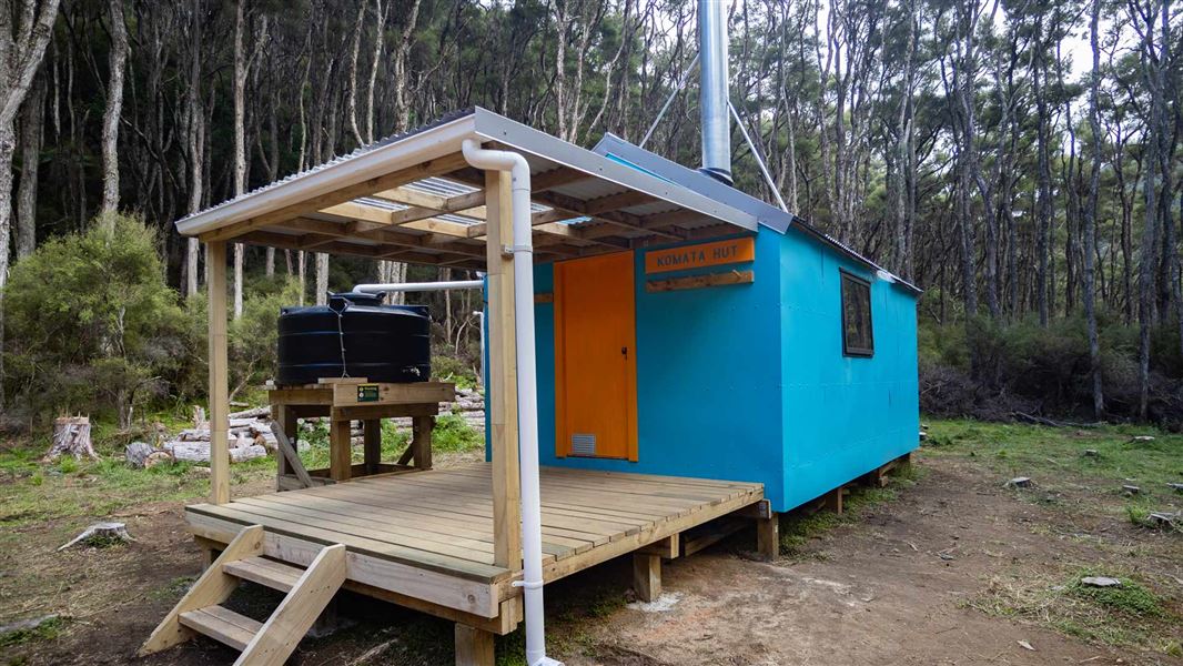
Komata Hut is situated 30 m above the Ngaruroro River, in a clearing amongst manuka and kanuka forest.
Komata Hut (previously known as Comet Hut) was built prior to the early 1960s and originally located at the end of Comet Road. It was relocated in early 2024 to Ngaruroro Valley, due to ongoing issues at the Comet Road site.
The hut was restored and rebuilt, but it retains a range of original features. These include the original flooring, framing and rafters. The cladding and roofing from the original has been used to build a woodshed on site, and also for features within the hut itself. The original name of the hut has also been restored, as per the 1989 maps of the area.
The relocation and restoration, including the new track to the site, was completed by an all-female team of Backcountry Trust volunteers over an 18 month period between late 2022 and March 2024.
There are no tracks beyond Komata Hut and no helicopter landings allowed due to the terrain.
Turn off the Taihape Napier Road onto Comet Road. The Comet Road turn off is about 70 km (1 hr 15 min drive time) from Hastings. Follow Comet Road until the end (3 km).
A forestry gate has been installed at the start of Comet Road to allow for closure in the event of unsafe road conditions. If the road is closed, an alert will be displayed on this page.
Take Komata Hut Track to Komata Hut. It is 3-4 hr from Comet Road end to Komata Hut. The trip back out to the road will take 4-5 hr.
River access
There is an orange arrow marking the takeout from the river, with a 10-minute track leading from here to Komata Hut.
Ngaruroro Lower Gorge is a Grade 3+ to Grade 4 trip and is suitable for experienced paddlers only. The river is especially challenging downriver from Komata Hut – there are significant hazards. Do not attempt this trip alone, or if you do not have the skills for it.
Read more about the river:
Tracks to this hut
-
Duration: 3-4 hr to the hut | 4-5 hr out from the hut Difficulty: Advanced
Location
NZTM GR 1885601 5624852
The hut location and track are not on the Topo50 map
The new location of the hut and the track to it does not show on the LINZ Topo50 map yet.
Rafting the Ngaruroro River is a challenging trip
Rafting the Ngaruroro River is a challenging trip and is suitable only for experienced paddlers. If you are considering attempting it, read about what to expect and ensure you have the skills and equipment for it.
DOC Customer Service Centre
| Phone: | 0800 275 362 |
| Email: | napier@doc.govt.nz |
| Address: | Ahuriri / Napier Office |
