- Stream water supply
- Long drop style toilet
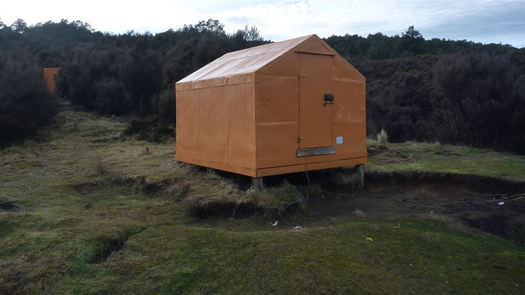
The bivouac was built in 1963 by the NZ Forest Service and is situated at 900 metres above sea level in a clearing at the base of Dicks Spur. The site has adequate camping space surrounding the bivouac and is an ideal location for a small hunting or tramping party. Originally this area was cleared by the turn of the last century for pastoral farming, but has since reverted to manuka and kanuka. Although relatively sheltered it can experience strong north-westerly winds and snow during winter.
Fees
Free
Walking
Makahu Saddle Carpark (1 hr)
The hut is reached via Makahu Saddle Hut which is situated at the Makahu Saddle car park (at the end of Kaweka Road). The benched track leaves from behind the hut, 5 minutes from the carpark.
Tramping
Kaweka Flats Bivouac is ideally located for a day, weekend or the start of an extended tramp. The track sidles through beech forest, in and out of sidestream gullies, in a northerly direction. It follows an old stock route which was used when grazing was prevalent between the 1860's and early 1900's. The vegetation gradually changes to thick regenerating manuka. The track carries on past the bivouac to Middle Hill Hut (3 hours), and then down to Makahu Road (another 2.5 – 3 hours). The historic iron whare can be reached from the Kaweka Flats Bivouac.
Care must be taken when negotiating stream crossings in times of high rainfall.
Kaweka Forest Park access conditions
We recommend 4WD vehicles to reduce wear on the road and safe travel.
- Lotkow Road: The river crossings are regularly changing, check before crossing.
- Lakes carpark is accessible via Kuripapango road. The previous access Castle Rock road is now closed due to ongoing forestry operations.
- Lawrence Carpark access road: The last 600 m of the road is steep and not recommended for 2WD vehicles - a parking space is available before the descent. The Lawrence swing bridge has been removed.
- Mackintosh car park is currently closed due to ongoing forestry operations. A new parking location can be located at a skid site near the closed gate (end of Kuripapango Road), this will add on 500 m walking to reach the start of the track.
- Whittle Road: Be aware of trucks using the quarry. Give them right of way where possible.
Tracks to this hut
-
Duration: 5.5-7.5 hrs Difficulty: Advanced
Location
NZTopo50 map sheet: BJ37
Grid/NZTM2000 coordinates: E1894796, N5648564
DOC Customer Service Centre
| Phone: | 0800 275 362 |
| Email: | napier@doc.govt.nz |
| Address: | Ahuriri / Napier Office |