Pindone application for Tekapo Mt John Walkway
Pindone will be applied to the area the Tekapo Mt John Walkway passes over on Saturday 9 August 2025. This is not public conservation land but the track travels through the operation area.
Pindone will be aerially applied by helicopter using GPS and trickle feed and broadcast buckets. Bait will be in the form of carrot coated with liquid pindone which will be a green colour and followed up later on with pindone pellets.
People are advised to avoid the area. Follow the warning signage at place.
Important information about Pindone
Pindone is poisonous to humans and domestic animals.
Observe the following rules whenever you see warning signs about the pesticide Pindone:
- Do not touch baits.
- Watch children at all times.
- Do not eat animals from this area or from within a 2 km radius outside the operational area boundary.
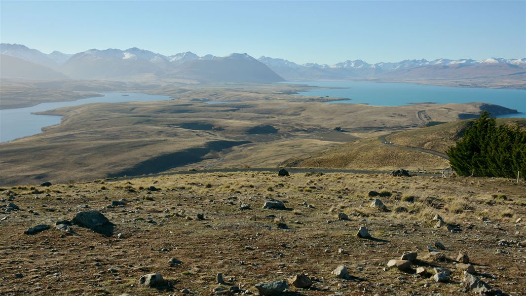
The track rises steadily up through exotic forest and then open tussock hill slopes. Mt John is fantastic viewing platform with a 360-degree panorama of the surrounding mountains, lakes and Mackenzie Basin flats. The Mt John Observatory and cafe are at the top.
Another popular option is to drive to the top of Mt John, park near the cafe and walk the Summit Circuit Track (30–45 min).
Mt John via lakeshore
Time: 3 hr
Walk past the Tekapo Springs complex and follow the track on the western side of Lake Tekapo. The track climbs up to Mt John Summit Track. Descend through the exotic forest back to where you started.
Mountain biking
No mountain bikes allowed.
The start of this track is located next to the Tekapo Springs complex.
Aoraki/Mount Cook National Park Visitor Centre
| Phone: | +64 3 435 1186 |
| Email: | mtcookvc@doc.govt.nz |
| Address: | 1 Larch Grove Aoraki/Mount Cook 7999 |
| Hours: | Visitor centre hours and services |