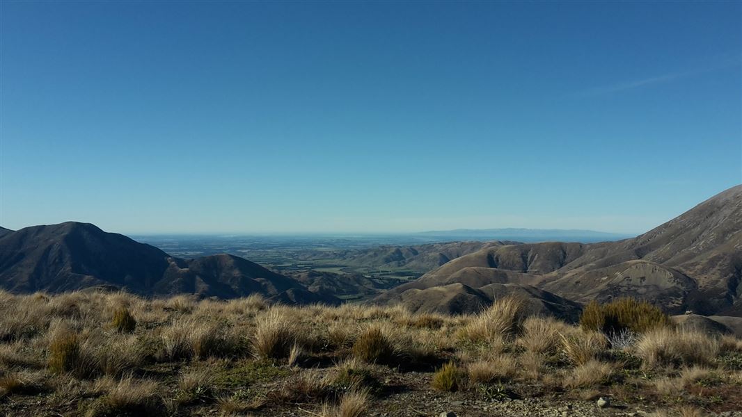
Travellers on SH73 between Christchurch and the West Coast gain an increasingly panoramic view of the park as they approach Porters Pass.
Korowai/Torlesse Tussocklands Park is a key site for the promotion and protection of eastern South Island high country landscapes and ecosystems.
The Torlesse Range is one of the most accessible in the country, located alongside SH73, only 75 minutes drive from Christchurch.
The main access points into the park are the Kowai River (private), Porters Pass, Lake Lyndon Road, Craigieburn Road, and the Porter Heights Skifield Road.
Access to some areas requires permission from neighbouring landholders.
Wasp populations reach high numbers from January to March – wear light-coloured clothing and carry antihistamine cream/tablets as a precaution.
The Torlesse and Big Ben are high, dry mountain ranges with remarkable flora and fauna. Slim-leaved snow tussock/wī kura is common and the high altitude tussock grasslands represent the eastern limit of mid-ribbed snow tussock. Other natural features within the park include:
- mountain beech/tawhairauriki forest
- species-rich shrublands
- unusual scree plants such as vegetable sheep and penwiper/porotaka, Haast’s scree buttercup, scree lobelia and scree pea
- native grasshoppers, wētā, cockroaches, lizards and butterflies
- kea, falcon/kārearea and pipit/pīhoihoi inhabit the grasslands
- tomtit/miromiro, riflemen/titipounamu, brown creeper/pīpipi are present in the beech forests.
From very early times, the area has held special significance for the first occupants the Waitaha, and through many generations to present day Ngāi Tahu. The dual name indicates the importance of the area to our local and national culture. Korowai (cloak) is symbolic of concepts such as embracement, collectiveness, togetherness and prestige. It recognises the historic connections the Ngāi Tahu tupuna (ancestor) Tanetiki had with the area.
The basins and ranges were an integral part of a network of trails, which were used to ensure the safest seasonal journeys and best access to mahinga kai (food-gathering places).
Charles Torlesse, a surveyor for the Canterbury provincial government, led by local Māori guides in January 1849, was the first European to climb the slopes of the range. A few men with picks, shovels and a government grant of 500 pounds, made the first track over Porters Pass in 1858–9. The original (Cobb and Co Coaches) road is still visible within the conservation park boundaries.
Other historic European sites within the park include the old pack track used by the Porter brothers, Avoca Homestead (1906) and the Mt Torlesse Colleries Coal Mines, which operated from 1918 to 1927.
Arthur's Pass National Park Visitor Centre
| Phone: | +64 3 318 9211 |
| Email: | arthurspassvc@doc.govt.nz |
| Address: | 104 West Coast Road Arthur's Pass 7654 |
| Hours: | Visitor centre hours and services |
